vol 2 num 4

from VizMAP – letting you see where you stand…
Volume 2 – Number 4
|
| About VizMAP
VizMAP Pty Ltd, is a leading supplier of terrain Visualisation and related services to the defence, GIS, environmental, mapping, mining and exploration industries, engineering and construction firms, developers and planners, as well as government administration departments dealing with land, transportation and the environment.
VizMAP‘s products are designed to be run on reasonably to highly configured graphics computers (PC, Linux and Unix) for public display, group training, mission rehearsal, environmental monitoring, etc. and to enhance management decision making.
VizMAP is headquartered on Queensland’s Sunshine Coast (Australia) with affiliation in Asia, Europe, Africa and the USA and thereby provides support and services to customers worldwide.
If you need to visualise anything geographic, e-mail VizMAP here with the details.
For more information about VizMAP visit the VizMAP Web site at http://www.vizmap.com.au.
|
VirtualGeography
Subscription
Details
To subscribe to VirtualGeography,
click here.
To unsubscribe to VirtualGeography,
click here.
|
A Moment’s Notice
Drinking coffee for instant relaxation? That’s like drinking alcohol for instant motor skills. — Marc Price

|
|
VirtualGeography – the newsletter
|
| G’Day… and Welcome to VirtualGeography |
from VizMAP |
| Welcome to another free VirtualGeography from VizMAP Pty Ltd.
I have to apologise that this one is a little late but I’m, currently on a Land Administration assignment in the Solomon Islands and the internet access here leaves a little to be desired.
VirtualGeography is a collection of interesting snippets from all over the shop, dealing with industry issues concerning the computer based visualisation of geography and a few other associated (or otherwise) interesting bits and pieces. You are receiving this either because you subscribed to VirtualGeography or you have had recent dealings with VizMAP Pty Ltd. If you do not wish to receive further instalments of VirtualGeography, just click on the unsubscribe link at the bottom of this e-mail.
A new VirtualGeography is pushed out about once per month, towards the end of the month, which shouldn’t be too big a drain on your mailbox if you’re not already subscribed (of course it won’t be a drain on your mailbox if you ARE subscribed, either  ). If you know of anyone who might like to get VirtualGeography, feel free to forward this to them and ask them to subscribe. By the way, subscription and unsubscription details are at the bottom (click here). ). If you know of anyone who might like to get VirtualGeography, feel free to forward this to them and ask them to subscribe. By the way, subscription and unsubscription details are at the bottom (click here).
So, g’day to all you enthusiasts requiring to visualise and simulate both urban and rural geographic information (GIS), cartography, photogrammetry, remote sensing, digital elevation modelling (DEM) and general mapping.
|
By the spelling of "Visualisation" you may have already guessed that we’re not US based – that’s a good thing, or at least not a bad thing. This comes to you from Mooloolaba on the Sunshine Coast of Queensland, Australia, where it’s beautiful one day and perfect the next.
The link between visualisation and mapping may seem a little esoteric if this is your first encounter with this sort of stuff, but let me tell you, the bond is significant… but enough of that: on with the show… I hope you like it. Any feedback you might have is highly appreciated. E-mail me here to make your comments.
Enjoy…
Graeme Brooke
VizMAP Pty Ltd
|
 |
P.S. You’ll need an active internet connection to view any images that are in the content. We’ve done it this way to keep the size of the e-mail to a minimum.
|
| |
Back to Top |
| The Industry’s Two Cents Worth… |
| New 21st century technology leads the fight against flooding |
from SpatialNews |
| On 21st March 2003, British Waterways launched their GeoScaN system , designed to offer engineers valuable tools and information in flood prevention work.
The system, developed by the Technical Services Department of British Waterways at Leeds, offers the worlds first boat-mounted inland waterway 3D spatial survey system.
The GeoScaN system will provide information on the canal and river beds, heights of banks above water level and provide information on bank protection. Research has been ongoing into the dredging of river and heights of flood banks and the effects on recent floods. Now this research can be carried out in one simple exercise, offering agencies and the general public much needed reassurance.
In addition the system will provide a geographical reference for all structures such as locks, bridges and weirs. All the information will be logged on computer and will also be recorded on digital video for future reference. Positional information will utilise Differential GPS as well as satellite imaging for flood plain mapping.
Laurence Waterhouse, the system designer at British Waterways said “The GeoScaN project is cutting-edge technology utilising lasers, infra red sensors and sub-bottom profiling and we are taking out a patent for the system. As far as I know it is the first time combined hydrographic/topographic/GIS data collection from one piece of equipment has been used.
We will be able survey everything above the water line with a scanning laser, whilst profiling the bed with scanning sonar. This is all linked to a sub metre accuracy DGPS offering a resolution of less than 0.9m RMS horizontal and less than 3cm vertical. All the data collected can be verified by four on board digital video cameras also linked to DGPS. These cameras follow the line of the laser scanners so data can be checked and assigned to GIS assets. The boat is also fitted with an underwater infra red video camera and a magnetometer
It will offer real time information on dredging requirements, flood bank height and condition, asset location etc, in fact all the data that hydrologists and flood defence engineers have been requesting for years. Until now, actual collection has entailed sending out three or four different teams of surveyors which takes time and costs money. Now we will be able to collect the data quickly, efficiently and economically.
In fact this system does it all ”
|
| Read that full story here |
Back to Top |
| Hardcore Stuff (hardware bits)… |
| Germany’s Waterway Engineering and Research Institute Chooses SGI Supercomputers to Meet Simulation Challenges of the Future |
from Intel |
| SGI Origin 3000 Systems Used to Analyze and Optimize Constructive Measures in Coastal River Systems image downloads
MOUNTAIN VIEW, Calif. (March 19, 2003)–SGI (NYSE: SGI) today announ-ced that Germany’s Waterway Engineering and Research Institute (BAW) heavily invested in SGI® technology for high-performance computing (HPC) to meet challenges in future numerical simulation projects. BAW’s coastal division in Hamburg, which designs, monitors, analyzes and repairs all waterways and tidal flood zones in the country’s coastal areas, has installed two of the new SGI® Origin® 3000 servers. The two supercomputers harness the power of 288 MIPS® processors and run the high-performance SGI® IRIX® operating system.
The acquisition worth approximately €3 million (roughly $3.2 million U.S.) will not only greatly increase computing power for performance-hungry users, but will also establish an HPC environment that offers highly flexible usability and uniquely enhances supercom-puting productivity. The new SGI platform replaces BAW’s former vector-based supercomputer system, Cray SV1TM, and won the business over other major vendors’ competitive system offerings by delivering convincing benchmark performance and the best price/performance value.
Using computer modeling and numerical simulation techniques, BAW achieves an increasingly precise understanding of the complex physical processes that govern fluid dynamics and suspended material transport phenomena within tides-influenced coastal waterway systems like the big river mouths of Elbe, Weser and Ems.
|
| Read that full story here |
Back to Top |
| Softcore Stuff (software and data bits)… |
| Use of NOAA data to update nautical charts |
from GIS Development |
| Maptech Digital Charts include 10,741 "Notice to Mariner" Critical Changes Included in Digital ChartKit and Marine Navigator
Sometimes one of the most important factors in marine navigation goes unnoticed. Each year thousands of Notice to Mariner (NTM) changes takes place in US waters. Typical changes include relocation of navigation aids; channel shifts and shoaling; depth soundings, submerged obstructions (like rocks, jetties, and wrecks); and new danger areas.
NOAA (National Oceanic and Atmospheric Administration) charts are the bible for commercial and recreational boaters. Many captains, as well as recreational boaters are unaware of the extent and the importance of these changes for safer navigation; changes that may not be included even in a current edition of a chart. Maptech is the only company that includes all the "critical changes" to produce up-to-date digital NOAA charts. These changes are incorporated into a variety of Maptech products that include Digital ChartKit and Marine Navigator CD-ROMs, as well as new editions of Maptech paper waterproof charts and ChartKit books.
Each year Maptech offers a substantial discount to existing customers to stay current and update their digital charts for less than $100 per Region – a 50% discount. In addition new users are offered a special CD at the time of purchase that includes any new NOAA chart editions. This exclusive Maptech procedure (NTM changes and NOAA new chart editions) gives buyers the advantage of using the most current NOAA charts for the area purchased.
Last year 10,741 Notice to Mariner critical changes occurred in US waters. A "critical change" is defined as a change that impacts safe navigation. These changes are published only by Maptech on a weekly basis as part of an update service that is delivered to subscribers over the Internet
|
| Read that full story here |
Back to Top |
| Shop ‘n Save |
from VizMAP |
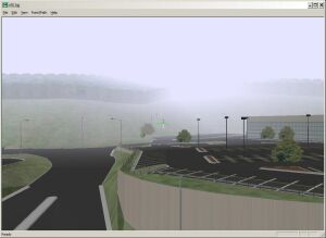
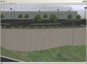
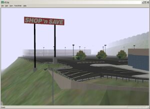
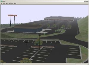
| VizMAP uses TerraTools from TerraSim to create it’s Vis-Sim databases. This is an example from TerraSim of a modelled shopping centre in the USA
Sample still images from the completed dynamic visualisation database are displayed here. An active internet connection is required to be able to view these scenes.
Click on these small resampled images to view the full screen images on the VizMAP website. Bear in mind that these are just screen dumps from a dynamic, interactive, 3D "flythrough".
|
| If you have a need to dynamically visualise your geographic data, let VizMAP know your requirements… |
Back to Top |
| Spinning a Silver Disc |
from Apple |
| Last year media designer Dave Gare landed a Fortune 10 company on a 5-inch silver disc. It was a tricky piece of business, even for Gare, a renowned video designer who for the past 15 years has helped some of the best-known companies in the world (Prudential, BMW, Bell Atlantic) brand and spin their products, messages and results.
This time the spinning was literal. Gare’s company, Intuitive I.N.K., moved Verizon’s branding guidelines, previously scattered across various locations and media, onto a single DVD disc, complete with interactive motion menus and full-screen video exposition.
Verizon’s reasons for publishing the disc make as strong a case for DVD publishing as Gare’s immaculate results. Although influenced by the sheer capacity of the format, the company’s move to DVD was ultimately triggered by customer requests for media choice and meaningful interaction. “For corporations, there is truly useful interactivity in DVD,” says Gare. Reason enough for any business to go there and with DVD Studio Pro, easy enough to do.
No Medium, No Message
It was not always so easy. Gare, who experimented with multiplexed media long before he had anywhere to play it, developed an appetite for digital motion graphics during his graduate studies at the Apple Media Center in 1988. “We had only postage stamp-sized video running at 4 frames a second,” Gare remembers, “but it was the most incredible thing we’d ever seen. I knew someday the Mac would do full-speed, full-frame video and motion graphics on the desktop. We waited and waited.”
|
| Read that full story here |
Back to Top |
| Whazzup Next – with 20/20 Foresight… |
Stuff to look out for in April, May & June
| Legend |
| Included in last issue… |
| Updated since last issue… |
| New since last issue… |
|
This calendar of events has been collated from:
|
| April 2003 |
| 1-3 Apr 2003 |
3rd International Conference on Computer Vision Systems "ICVS’03" ISPRS Comm.III |
Graz, Austria |
| 2-3 Apr 2003 |
BAPCO 2003, The Public Safety Communications and IT Event |
London, UK |
| 2-3 Apr 2003 |
APAS (Association of Public Authority Surveyors ) Conference |
Wollongong, NSW Australia |
| 2-4 Apr 2003 |
PikeNet Forum |
Chicago, IL USA |
| 5-10 Apr 2003 |
XI Brazilian Remote Sensing Symposium "XI SBSR" |
Belo Horizonte, Brazil |
| 6-11 Apr 2003 |
EGS-AGU-EUG 2003 Joint Assembly |
Nice, France |
| 7-10 Apr 2003 |
7th Annual Intermountain GIS Conference |
Coeur d’Alene, ID, USA |
| 7-11 Apr 2003 |
2nd SCAR International Antarcic GIS Workshop |
Freiburg, Germany |
| 8-9 Apr 2003 |
Mobile Entertainment 2003 |
London, UK |
| 8-9 Apr 2003 |
China Wireless Shanghai 2003 |
Shanghai, PRC China |
| 8-12 Apr 2003 |
International Congress "Enter the Past -The E-way into the four Dimensions of Cultural Heritage" |
Vienna, Austria |
| 9-10 Apr 2003 |
Pharmaceutical Product Liability |
London, United Kingdom |
| 9-11 Apr 2003 |
California GIS Conference |
Palm Springs, CA, USA |
| 9-12 Apr 2003 |
IBM developerWorks 2003 |
New Orleans, LA USA |
| 10-11 Apr 2003 |
Avenza Systems Training |
Toronto, Canada |
| 13-15 Apr 2003 |
Drilling & Blasting 2003 |
San Antonio, TX, USA |
| 13-16 Apr 2003 |
National Conference on Coastal and Estuarine Habitat Restoration |
Baltimore, Maryland, USA |
| 13-17 Apr 2003 |
FIG Working Week and XXVI General Assembly 125th Anniversary of the International Federation of Surveyors |
Paris, France |
| 14-16 Apr 2003 |
The GEBCO Project 1903-2003 |
Monaco |
| 15-17 Apr 2003 |
Powerline Communications & Technology |
Hong Kong, China |
| 15-17 Apr 2003 |
VirtualGISCafe – World’s First Virtual GIS Exhibit |
Internet (USA – 8:00 AM – 5:00 PM PST) |
| 21-22 Apr 2003 |
6th International Wireless & Beyond Japan |
Tokyo, Japan |
| 21-23 Apr 2003 |
GIS in Action Conference |
Portland, Oregon, USA |
| 21-25 Apr 2003 |
SPIE’s 17th Annual International Symposium on Aerospace/Defense Sensing, Simulation, and Controls "AeroSense 2003" |
Orlando, Florida USA |
| 21-25 Apr 2003 |
Resource Management Tools Conference |
Pheonix AZ, USA |
| 22-25 Apr 2003 |
GNSS 2003 – The European Navigation Conference |
Graz, Austria |
| 23 Apr 2003 |
GITA Webinar… Using GIS to Bolster Emergency Services and Homeland Defense |
Web-based |
| 24-25 Apr 2003 |
Avenza Systems Training |
Washington D.C, USA |
| 24-26 Apr 2003 |
6th AGILE Conference on Geographic Information Science "AGILE 2003: The Science behind the Infrastructure" |
Lyon, France |
| 26 Apr – 1 May 2003 |
EURESCO Conferece "Geographical Domain and Geographical Information Systems: Modelling for Wayfinding Services" |
Bad Herrenalb, Germany |
| 27-30 Apr 2003 |
Tobin Conference 2003 |
San Antonio, TX USA |
| 28-29 Apr 2003 |
EF Telecoms’ Third Annual Mobile Payment Systems |
London, UK |
| 28-30 Apr 2003 |
ISPRS Council Meeting |
Sydney, Australia |
| 28-30 Apr 2003 |
13th Annual Nevada State GIS Conference |
Reno, Nevada, USA |
| 28-30 Apr 2003 |
Delaware GIS 2003 Conference |
Newark, Delaware, USA |
| 29-30 Apr 2003 |
Symbian Developers Expo |
London, UK |
| May 2003 |
| 4-7 May, 2003 |
ESRI International Health User Conference |
Arlington, VA USA |
| 5-7 May, 2003 |
IMAGIN 2003 Conference |
Kalamazoo, MI |
| 5-9 May, 2003 |
ASPRS 2003 |
Anchorage, AK USA |
| 5-9 May, 2003 |
Water Distribution Modeling Symposium |
Perugia, Italy |
| 5 May -13 June, 2003 |
Thirteenth United Nations/Sweden International Training Course on Remote Sensing Education for Educators |
Stockholm and Kiruna,
Sweden |
| 7-9 May, 2003 |
GeoAlberta 2003 |
Calgary, Alberta, Canada |
| 9-14 May, 2003 |
Socio-Economic Research and Geographic Information Systems |
Spa, Belgium |
| 11-16 May, 2003 |
Fifth Science and Management of Protected Areas Conference (SAMPA V) |
Victoria, British Columbia, Canada |
| 12-16 May, 2003 |
GIS BRASIL 2003 – 9th GEOTECHNOLOGIES TRADESHOW |
São Paulo City, São Paulo State, Brazil |
| 12-16 May, 2003 |
GTC West 2003 |
Sacramento, CA USA |
| 15-16 May, 2003 |
Avenza Systems Training |
Denver, CO USA |
| 15-17 May, 2003 |
EASY-ECO 2 |
Vienna, Austria |
| 18-22 May, 2003 |
2003 Bentley International User Conference |
Baltimore, MD USA |
| 18-23 May, 2003 |
21st AARB and 11th REAAA (Road Engineering Association of Asia and Australasia) Joint Conference – Transport – our highway to a sustainable future |
Cairns, Qld, Australia |
| 19-21 May, 2003 |
GeoSpatial World 2003 |
New Orleans, LA USA |
| 19-21 May, 2003 |
MOBILE AMERICAS 2003 |
Miami, FL USA |
| 19-23 May, 2003 |
United Nations/Romania Regional Workshop on the Use of Space Technology for Disaster Management for Europe |
Sinaia, ROMANIA |
| 22-23 May, 2003 |
2nd Joint ISPRS WG III/6 /IEEE Workshop on Remote Sensing and Data Fusion over Urban Areas (URBAN 2003) |
Berlin, GERMANY |
| 25-28 May, 2003 |
11th International Symposium on Deformation Measurements |
Santorini, GREECE |
| 26-29 May, 2003 |
3rd International Conference on GIS – for Earth Science Applications |
Ljubljana, Slovenia |
| 26-28 May, 2003 |
8th ISU Annual International Symposium Satellite Navigation Systems: Policy, Commercial and Technical Interaction |
Strasbourg, France |
| 26-29 May, 2003 |
SimTecT 2003 — ‘Simulation – Delivering Tomorrow Today’ |
Adelaide, South Australia, Australia |
| 27-29 May, 2003 |
8th International Conference on Computers in Urban Planning and Urban Management |
Sendai, Japan |
| 27-31 May, 2003 |
CAG 2003 ACG |
Victoria, British Columbia, Canada |
| 28-31 May, 2003 |
1st Taipei International Conference on Digital Earth |
Taipei, TAIWAN |
| June 2003 |
| 2-3 Jun 2003 |
TUGIS 2003, the 16th Annual GIS Conference |
Baltimore, MD USA |
| 2-5 Jun 2003 |
23rd EARSeL Annual Symposium "Remote Sensing in Transition" |
Gent, Belgium |
| 2-5 Jun 2003 |
AEC Systems 2003 |
Washington, USA |
| 2-6 Jun 2003 |
International Symposium on Spectral Sensing Research (ISSSR 2003) ISPRS WG VII/1 |
Santa Barbara, CA, USA |
| 2-6 Jun 2003 |
ISSRM 2004 (International Symposium of Society and Resource Management) 2004 |
Keystone Resort, Colorado USA |
| 3 Jun 2003 |
GITA Webinar… Geospatial Information: Government and Municipal Perspectives |
WWW |
| 3-6 Jun 2003 |
ISPRS WG IV/8 Workshop "Global Environmental Databases: Adaptation to Meet Current & Future Needs" |
Bangkok, Thailand |
| 4-6 Jun 2003 |
ScanGIS’2003 – The 9th Scandinavian Research Conference on Geographic Information Science |
Espoo, Finland |
| 6-7 Jun 2003 |
EARSeL Workshops "Forest Fires and Coastal Zones" |
Gent Belgium |
| 12-13 Jun 2003 |
FME Training |
Vancouver, BC, Canada |
| 15-18 Jun 2003 |
IST Mobile & Wireless Communications Summit 2003 |
Aveiro, Portugal |
| 17-19 Jun 2003 |
ISPRS Joint Workshop of WG I/3 and WG II/2: Three-Dimensional Mapping from InSAR and LIDAR |
Portland, OR, USA |
| 23-26 Jun 2003 |
The 2003 International Conference on Machine Learning;Models, Technologies and Applications (MLMTA) |
Las Vegas, Nevada, USA |
| 24-27 Jun 2003 |
Space 2003-NavSat 2003 CHINA |
Geneva, Switzerland |
| 24-25 Jun 2003 |
11th Annual Pennsylvania GIS Conference |
Harrisburg, PA USA |
| 25-26 Jun 2003 |
2003 GenaWare Annual Symposium |
Durham, NC USA |
| 25-27 Jun 2003 |
The 11th International Conference on Geoinformatics’ 2003: Advanced Geoinformatics – Linking Pacific Rims to the World |
Toronto, Canada |
| 27-29 Jun 2003 |
ISPRS WG VII/4 4th International Symposium "REMOTE SENSING OF URBAN AREAS 2003" |
Regensburg, Germany |
| 30 Jun – 11 Jul 2003 |
23rd IUGG General Assembly "IUGG 2003" |
Sapporo, Japan |
|
| |
Back to Top |
A Parting Gesture… |
| Tech Support |
From JokeADay |
| I had to call tech support. While I think I’m above average in the computer smarts department, there were a couple of things that needed some serious tweaking as far as network settings.What a mistake that was. Not so much that the fella I got didn’t know what he was talking about. I guess he did. It was me that didn’t understand half of what he was saying.
I said, "Sir, how about this. Why not explain what I should do as if I were a small child."
He said, "Ok. Son, could you please put your mummy on the phone?"
|
 |
Back to Top |

Feel free to forward this to whomsoever you wish.
To e-mail the VirtualGeography Editor, click here.
To subscribe to VirtualGeography, click here.
To unsubscribe to VirtualGeography, click here.
…that’s all, folks! (for now).
|
|
VizMAP
- Bureau & Services Portfolio
- Contact Us
- News
- Gladstone Port Access Road nearly complete after VizMAP visualisation convinces Council
- TerraTools Exporter for Virtual Battlespace 2 (VBS2) Now Available – 23/3/9
- Updated interactive “Flash Map” of Advanced Mining Projects in Queensland by VizMAP to be distributed to delegates of Mining 2006
- VizMAP & E2E deliver workshop at Queensland Spatial Conference, Brisbane, Queensland – 17/7/8
- VizMAP creates “virtual trek” to the Everest Base Camp
- VizMAP creates virtual coal mine for central Kalimantan
- VizMAP develops interactive “Flash Map” of Advanced Mining Projects in Queensland
- VizMAP imagery of Virtual Surat Energy Province awarded image of the month by Image Society Inc.
- VizMAP Launched
- VizMAP launches FlyLG: computer based geospatial Visualisation tailored to Australian local government areas
- VizMAP presents at Australia Pacific Spatial Innovation Conference 08, Canberra, ACT – 19/11/8
- VizMAP presents at GITA 07, Brisbane, Queensland – 8/8/7
- VizMAP presents at GITA Seminar, Darwin, Northern Territory – October, 2006
- VizMAP presents at Queensland Spatial Conference 2008, Brisbane, Queensland – 18/7/8
- VizMAP presents at Surveying and Spatial Sciences Institute (SSSI) Meeting, Hervey Bay
- VizMAP Presents TerraTours® Visualization at World Energy Congress
- VizMAP presents to Darling Downs Interest Group in GIS and Remote Sensing (DIGGARS) Seminar, USQ, Toowoomba, Queensland – 8/11/7
- VizMAP presents to International Map Trade Association (IMTA), Surfer’s Paradise, Queensland – 2/11/7
- VizMAP presents to Queensland Spatial Industry Council (QSIC), Brisbane, Queensland – 22/11/7
- VizMAP writes for Position Magazine – “The 3D Industry” – April-May 2007, No 28
- VizMAP’s Virtual Surat Energy Province
- VirtualGeography Index
- VizMAP
|


