|
|
vol 6 num 1

from VizMAP – letting you see where you stand…
Volume 6 Number 1
|
About VizMAP
VizMAP Pty Ltd, is a leading supplier of terrain Visualisation and related services to the defence, GIS, environmental, mapping, mining and exploration industries, engineering and construction firms, developers and planners, as well as government administration departments dealing with land, transportation and the environment.
VizMAP’s products are designed to be run on reasonably to highly configured graphics computers (PC, Linux and Unix) for public display, group training, mission rehearsal, environmental monitoring, etc. and to enhance management decision making.
VizMAP is headquartered on Queensland’s Sunshine Coast (Australia) with affiliation in Asia, Europe, Africa and the USA and thereby provides support and services to customers worldwide.
If you need to visualise anything geographic, e-mail VizMAP here with the details.
For more information about VizMAP visit the VizMAP Web site at http://www.vizmap.com.au.
|
VirtualGeography
Subscription
Details
To subscribe to VirtualGeography,
click here.
To unsubscribe from VirtualGeography,
click here.
|
|
(1) X=Y
(Given)
(2) X2=XY
(Multiply both
sides by X)
(3) X2-Y2=XY-Y2
(Subtract Y2
from both sides)
(4) (X+Y)(X-Y)=Y(X-Y)
(Factor)
(5) X+Y=Y
(Cancel out
(X-Y) term)
(6) 2Y=Y
(Substitute
X for Y, by
equation 1)
(7) 2=1
(Divide both
sides by Y)
— "Omni", proof that 2 equals 1
|
|
VirtualGeography – the newsletter
|
| G’Day… and Welcome to VirtualGeography |
from VizMAP |
| Welcome to another free VirtualGeography from VizMAP Pty Ltd.
VizMAP had another good quarter with repeat business for the Queensland State Government, Praetorian, the Iron Boomerang and the Cadia Valley Minesite (see A Recent Outing, later).
Also, I was lucky enough to have the Australian GIS magazine Position publish my article entitled "The 3D Industry" in which I detail the rise of 3D geospatial stuff over the past few years. It’s been an interesting ride.
If you didn’t already know, VirtualGeography is a collection of interesting snippets from all over the shop, dealing with industry issues concerning the computer based visualisation of geography and a few other associated (or otherwise) interesting bits and pieces. You are receiving this either because you subscribed to VirtualGeography or you have had recent dealings with VizMAP Pty Ltd. If you do not wish to receive further instalments of VirtualGeography, just click on the unsubscribe link at the bottom of this e-mail.
A new VirtualGeography is pushed out every now and then when we’ve collated enough interesting bits and pieces, which shouldn’t be too big a drain on your mailbox if you’re not already subscribed (of course it won’t be a drain on your mailbox if you ARE subscribed, either  ). The regularity of the distribution may vary depending on what else is going on at VizMAP at the time. If you know of anyone who might like to get VirtualGeography, feel free to forward this to them and ask them to subscribe. By the way, subscription and unsubscription details are at the bottom (click here). ). The regularity of the distribution may vary depending on what else is going on at VizMAP at the time. If you know of anyone who might like to get VirtualGeography, feel free to forward this to them and ask them to subscribe. By the way, subscription and unsubscription details are at the bottom (click here).
So, g’day to all you enthusiasts requiring to visualise and simulate both urban and rural geographic information (GIS), cartography, photogrammetry, remote sensing, digital elevation modelling (DEM) and general mapping.
By the spelling of "Visualisation" you may have already guessed that we’re not US based – that’s a good thing, or at least not a bad thing. This comes to you from Mooloolaba on the Sunshine Coast of Queensland, Australia, where it’s beautiful one day and perfect the next. As a postscript to that, you can have a look at the Mooloolaba beach, now, 800m from where I sit as I write this, here.
|
The link between visualisation and mapping may seem a little esoteric if this is your first encounter with this sort of stuff, but let me tell you, the bond is significant… but enough of that: on with the show… I hope you like it. Any feedback you might have is highly appreciated. E-mail me here to make your comments.
Enjoy…
Graeme Brooke
VizMAP Pty Ltd
|
 |
P.S. You’ll need an active internet connection to view any images that are in the content. We’ve done it this way to keep the size of the e-mail to a minimum.
|
| |
Back to Top |
| The Industry’s Two Cents Worth… |
| Microsoft Virtual Earth |
from Microsoft |
| The Virtual Earth platform is an integrated set of services that combines unique bird’s eye, aerial, and 3D imagery with best-of-breed mapping, location and search functionality. With ongoing investments in innovation that are driven by customer feedback, the Virtual Earth platform 5.0 continues to offer new tools, advanced feature enhancements, and robust platform capabilities. In this latest release, the new Virtual Earth Platform is even more flexible, providing a wider range of supported capabilities that allow your business to strengthen customer relationships with innovative solutions and breakthrough experiences. By combining comprehensive support for feature customization, richer features for end users, and new levels of control and flexibility in the platform, Virtual Earth allows you to create unique environments to connect with your customers. The Virtual Earth platform has become the best solution available on the market for businesses and government customers.
The Virtual Earth Platform enables businesses to easily and cost-effectively customize unique location experiences for end customers. By providing multiple tools and greater control to change the way location solutions can be developed, businesses can continuously provide and update their online experience to ensure they remain competitive. Add bird’s eye or 3D imagery to real estate applications to show prospective clients, enhance your store locator with the dynamic, drag-n-drop maps, or provide your fleet drivers with highly-visual driving directions. The possibilities are endless.
|
| Read that full story here |
Back to Top |
| Hardcore Stuff (hardware bits)… |
| Nature provides a chip off the old shell |
from IBM |
| Taking a cue from seashells, IBM is using a pattern-creating process found in nature to manufacture its latest computer chips. The company has adapted the process that forms seashells, snowflakes, and enamel on teeth to make trillions of holes that provide insulating vacuums around the nano-scale wires inside each chip. As a result, the new chips work 35 percent faster or consume 15 percent less energy than even the most advanced chips using conventional techniques.
Although this new form of insulation is commonly referred to as "airgaps", the gaps are really airless vacuum. Scientist see vacuum as the ultimate antidote for what is known as wiring capacitance. That occurs when two conductors, in this case adjacent wires on a chip, siphon electrical energy from one another, generating heat and slowing the data as it moves through a chip.
IBM’s patented technique uses a mix of special compounds to form a vacuum between the miles of copper wires on a chip.
"This is the first time anyone has proven the ability to synthesize mass quantities of these self-assembled polymers and integrate them into an existing manufacturing process with great yield results," said Dan Edelstein, IBM Fellow and chief scientist of the self- assembly airgap project. "By moving self assembly from the lab to the fab, we are able to make chips that are smaller, faster and consume less power than existing materials and design architectures allow."
|
| Read that full story here |
Back to Top |
| Softcore Stuff (software & data bits)… |
| OneSAF Database Export for TerraTools 3.0 Available |
from TerraSim |
| TerraSim is pleased to announce the immediate availability of the OneSAF Version 1.0 export plug-in for TerraTools® 3.0. This plug-in allows users to create OneSAF Terrain Format (OTF) compliant databases for the OOS runtime environment.
The TerraTools appearance editor, TAEdit, has been updated to support automatic mapping of common source data attribution to the OneSAF environmental data model (EDM). These mappings are fully extensible by the user using TAEdit.
In addition to OTF terrain export, TerraTools 3.0 supports the generation of correlated export of SEDRIS 4.0 transmittals, OpenFlight® 16.0 (with MetaFlightTM), and Tiled Scene Graph (TSG) in native OTF geodetic format.
TerraTools 3.0 has already been used to create sample terrains for the OneSAF Objective System Version 1.0, including 4 cell Fort Hood, JRTC, and 4 cell JNTC. In addition, supplemental databases created using TerraSim’s OTF export plug-in include Mosul, Iraq, and 14 cell JNTC.
By leveraging TerraTools’s industry leading capabilities in large scale urban database construction, OneSAF users can populate their databases with efficiently organized, highly detailed, and geospecific urban content while keeping the resulting terrain and database complexity within the OneSAF runtime requirements.
|
| Read that full story here |
Back to Top |
| Cadia Valley |
from VizMAP |
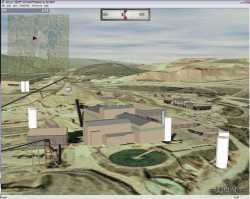
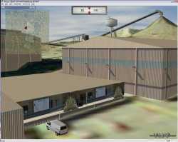
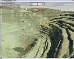
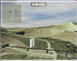
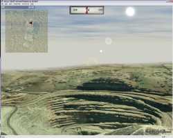
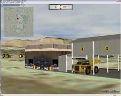
VizMAP was contracted by Newcrest Mining Ltd to create a 3D interactive visual database for their Cadia Valley Operations, the largest gold and copper producer in New South Wales and one of Australia’s largest gold producers. The operations comprise a large low grade Cadia Hill open pit mine (modelled) and the higher grade Ridgeway underground mine (not modelled).
Click on these small resampled images to view the full screen images from the VizMAP website. Bear in mind that these are just screen dumps from a dynamic, interactive, 3D "flythrough".
If you would like more information on this project, or need your own similar project performed, let VizMAP know
|
| If you have a need to dynamically visualise your geographic data, let VizMAP know your requirements… |
Back to Top |
| IBM opens sales center in Second Life |
from NetworkWorld |
| Sales avatars from IBM can work with client avatars up to the point of signing contracts and exchanging money
IBM today is opening a virtual business center at Second Life that will be staffed by IBM sales representatives from around the world.
Clients who want to buy hardware, software or services, or get help solving a business problem, can meet with a sales rep in the new IBM Business Center, which can be accessed here after 1 p.m. Eastern time today.
"The IBM sales avatar [in Second Life] can work with the client avatar up to the point of signing contracts and the passing of money or credit information. That would be handled through a link to IBM’s Web site or by phone," IBM says in a press release.
"We seek to engage with clients in the way they prefer to engage," Lee Dierdorff, vice president of Web strategy and enablement for IBM, said in a conference call this morning. "This may be over the Web, this may be over the telephone, and now it may be over a 3-D virtual world."
|
| Read that full story here |
Back to Top |
| Whazzup Next – with 20/20 Foresight… |
| Check these sites for events to look out for in the Vis/Sim, GIS, LIS, Remote Sensing & Photogrammetry calendars… |
|
| |
Back to Top |
A Parting Gesture… |
| The Head |
From Grime |
| A man is waiting for his wife to give birth. The doctor comes in and informs the dad that his son was born without torso, arms or legs. The son is just "a head"! But the dad loves his son and raises him as well as he can, with love and compassion.
After 18 years, the son is now old enough for his first drink. Dad takes him to the bar, tearfully tells the son he is proud of him and orders up the biggest, strongest drink for his boy. With all the bar patrons looking on curiously and the bartender shaking his head in disbelief, the boy takes his first sip of alcohol.
Swoooosh! Plop!! A torso pops out! The bar is dead silent; then bursts into whoops of joy. The father, shocked, begs his son to drink again. The patrons chant "Take another drink !"
The bartender continues to shake his head in dismay. Swoooosh! Plip! Plop!! Two arms pop out.
The bar goes wild. The father, crying and wailing, begs his son to drink again. The patrons chant, "Take another drink! Take another drink!!" The bartender ignores the whole affair and goes back to polishing glasses, shaking his head, clearly unimpressed by the amazing scenes.
By now the boy is getting tipsy, but with his new hands he reaches down, grabs his drink and guzzles the last of it. Plop! Plip!! Two legs pop out.
The bar is in chaos.
The father falls to his knees and tearfully thanks God. The boy stands up on his new legs and stumbles to the left then staggers to the right through the front door, into the street, where a truck runs over him and kills him instantly, the bar falls silent.
The father moans in grief. The bartender sighs and says, "He should have quit while he was a head!"
|
 |
Back to Top |
|
VizMAP
Letting you see where you stand…
Feel free to forward this to whomsoever you wish.
To e-mail the VirtualGeography Editor, click here.
To subscribe to VirtualGeography, click here.
To unsubscribe from VirtualGeography, click here.
|
| |
…that’s all, folks. For now…
|
|
VizMAP
- Bureau & Services Portfolio
- Contact Us
- News
- Gladstone Port Access Road nearly complete after VizMAP visualisation convinces Council
- TerraTools Exporter for Virtual Battlespace 2 (VBS2) Now Available – 23/3/9
- Updated interactive “Flash Map” of Advanced Mining Projects in Queensland by VizMAP to be distributed to delegates of Mining 2006
- VizMAP & E2E deliver workshop at Queensland Spatial Conference, Brisbane, Queensland – 17/7/8
- VizMAP creates “virtual trek” to the Everest Base Camp
- VizMAP creates virtual coal mine for central Kalimantan
- VizMAP develops interactive “Flash Map” of Advanced Mining Projects in Queensland
- VizMAP imagery of Virtual Surat Energy Province awarded image of the month by Image Society Inc.
- VizMAP Launched
- VizMAP launches FlyLG: computer based geospatial Visualisation tailored to Australian local government areas
- VizMAP presents at Australia Pacific Spatial Innovation Conference 08, Canberra, ACT – 19/11/8
- VizMAP presents at GITA 07, Brisbane, Queensland – 8/8/7
- VizMAP presents at GITA Seminar, Darwin, Northern Territory – October, 2006
- VizMAP presents at Queensland Spatial Conference 2008, Brisbane, Queensland – 18/7/8
- VizMAP presents at Surveying and Spatial Sciences Institute (SSSI) Meeting, Hervey Bay
- VizMAP Presents TerraTours® Visualization at World Energy Congress
- VizMAP presents to Darling Downs Interest Group in GIS and Remote Sensing (DIGGARS) Seminar, USQ, Toowoomba, Queensland – 8/11/7
- VizMAP presents to International Map Trade Association (IMTA), Surfer’s Paradise, Queensland – 2/11/7
- VizMAP presents to Queensland Spatial Industry Council (QSIC), Brisbane, Queensland – 22/11/7
- VizMAP writes for Position Magazine – “The 3D Industry” – April-May 2007, No 28
- VizMAP’s Virtual Surat Energy Province
- VirtualGeography Index
- VizMAP
|


