|
|
vol 6 num 2

from VizMAP – letting you see where you stand…
Volume 6 Number 2
|
About VizMAP
VizMAP Pty Ltd, is a leading supplier of terrain Visualisation and related services to the defence, GIS, environmental, mapping, mining and exploration industries, engineering and construction firms, developers and planners, as well as government administration departments dealing with land, transportation and the environment.
VizMAP’s products are designed to be run on reasonably to highly configured graphics computers (PC, Linux and Unix) for public display, group training, mission rehearsal, environmental monitoring, etc. and to enhance management decision making.
VizMAP is headquartered on Queensland’s Sunshine Coast (Australia) with affiliation in Asia, Europe, Africa and the USA and thereby provides support and services to customers worldwide.
If you need to visualise anything geographic, e-mail VizMAP here with the details.
For more information about VizMAP visit the VizMAP Web site at http://www.vizmap.com.au.
|
VirtualGeography
Subscription
Details
To subscribe to VirtualGeography,
click here.
To unsubscribe from VirtualGeography,
click here.
|
There is no such thing as gravity.
The Earth sucks.
– Unknown
|
|
VirtualGeography – the newsletter
|
| G’Day… and Welcome to VirtualGeography |
from VizMAP |
| Welcome to another free VirtualGeography from VizMAP Pty Ltd.
For the first time, VirtualGeography is going to be sent out on a dedicated List Server so I hope everything goes to plan. To do this, we’re using our sister site Grime. The Grime site was born way back in 1999 (12 months before VizMAP) as a vehicle to point to useful GIS freeware. We run it on a shoestring but it still gets an extraordinary amount of traffic. To go directly to the Grime freeware pages, start here.
The Grime List Server for VirtualGeography has been configured for newsletters only (i.e. from me to you) so you can’t respond to this e-mail. If you want to subscribe or unsubscribe, just do it (for the time being) as per the links at the bottom. If you want to respond, send me an e-mail here.
VizMAP is in the middle of a few very interesting projects at the moment, not the least impacting being a visualisation of a local port. This should be done and dusted by the next issue so look out for some pretty pictures then. In fact there is so much stuff coming up that we mightn’t get a chance to scratch for many months.
If you didn’t already know, VirtualGeography is a collection of interesting snippets from all over the shop, dealing with industry issues concerning the computer based visualisation of geography and a few other associated (or otherwise) interesting bits and pieces. You are receiving this either because you subscribed to VirtualGeography or you have had recent dealings with VizMAP Pty Ltd. If you do not wish to receive further instalments of VirtualGeography, just click on the unsubscribe link at the bottom of this e-mail.
A new VirtualGeography is pushed out every now and then when we’ve collated enough interesting bits and pieces, which shouldn’t be too big a drain on your mailbox if you’re not already subscribed (of course it won’t be a drain on your mailbox if you ARE subscribed, either  ). The regularity of the distribution may vary depending on what else is going on at VizMAP at the time. If you know of anyone who might like to get VirtualGeography, feel free to forward this to them and ask them to subscribe. By the way, subscription and unsubscription details are at the bottom (click here). ). The regularity of the distribution may vary depending on what else is going on at VizMAP at the time. If you know of anyone who might like to get VirtualGeography, feel free to forward this to them and ask them to subscribe. By the way, subscription and unsubscription details are at the bottom (click here).
So, g’day to all you enthusiasts requiring to visualise and simulate both urban and rural geographic information (GIS), cartography, photogrammetry, remote sensing, digital elevation modelling (DEM) and general mapping.
By the spelling of "Visualisation" you may have already guessed that we’re not US based – that’s a good thing, or at least not a bad thing. This comes to you from Mooloolaba on the Sunshine Coast of Queensland, Australia, where it’s beautiful one day and perfect the next. As a postscript to that, you can have a look at the Mooloolaba beach, now, 800m from where I sit as I write this, here.
|
The link between visualisation and mapping may seem a little esoteric if this is your first encounter with this sort of stuff, but let me tell you, the bond is significant… but enough of that: on with the show… I hope you like it. Any feedback you might have is highly appreciated. E-mail me here to make your comments.
Enjoy…
Graeme Brooke
VizMAP Pty Ltd
|
 |
P.S. You’ll need an active internet connection to view any images that are in the content. We’ve done it this way to keep the size of the e-mail to a minimum.
|
| |
Back to Top |
| The Industry’s Two Cents Worth… |
| Second Earth |
from Technology Review |
| The World Wide Web will soon be absorbed into the World Wide Sim: an environment combining elements of Second Life and Google Earth.
…The first, relatively simple step toward a Second Earth, many observers predict, will be integrating Second Life’s avatars, controls, and modeling tools into the Google Earth environment. Groups of users would then be able to walk, fly, or swim across Google’s simulated landscapes and explore intricate 3-D representations of the world’s most famous buildings. Google itself may or may not be considering such a project. "It’s interesting, and I think there are people who want to do that," says John Hanke, director of the division of the company responsible for Google Earth. "But that’s not something where we have any announcements or immediate plans to talk about it."
A second alternative would be to expand the surface area of Second Life by millions of square kilometers and model the new territory on the real earth, using the same topographical data and surface imagery contained in Google Earth. (The existing parts of Second Life could remain, perhaps as an imaginary archipelago somewhere in the Pacific.) That’s a much more difficult proposition, for practical, technical reasons that I’ll get to later. And in any case, Linden Lab says it’s not interested.
But within 10 to 20 years–roughly the same time it took for the Web to become what it is now–something much bigger than either of these alternatives may emerge: a true Metaverse. In Neal Stephenson’s 1992 novel Snow Crash, a classic of the dystopian "cyberpunk" genre, the Metaverse was a planet-size virtual city that could hold up to 120 million avatars, each representing someone in search of entertainment, trade, or social contact. The Metaverse that’s really on the way, some experts believe, will resemble Stephenson’s vision, but with many alterations. It will look like the real earth, and it will support even more users than the Snow Crash cyberworld, functioning as the agora, laboratory, and gateway for almost every type of information-based pursuit. It will be accessible both in its immersive, virtual-reality form and through peepholes like the screen of your cell phone as you make your way through the real world. And like the Web today, it will become "the standard way in which we think of life online," to quote from the Metaverse Roadmap, a forecast published this spring by an informal group of entrepreneurs, media producers, academics, and analysts (Cascio among them)…
|
| Read that full story here |
Back to Top |
| Hardcore Stuff (hardware bits)… |
| Tangible display makes 3D images touchable |
from NewScientistTech |
| A system that makes three dimensional images solid enough to grasp has been unveiled by Japanese firm NTT. It could let businesspeople shake hands from across the globe or allow museum visitors to feel precious exhibits that are normally out of reach, the company says.
The prototype Tangible 3D system combines a 3D display with a "haptic glove". The display creates lifelike images appear in just in front of a flat screen. It creates the illusion of depth by showing slightly different images to each of the viewer’s eyes. This means no special glasses are needed.
Attached to the display is a haptic glove. Once inside, a user’s hand is touched by numerous force-feedback components to make it feel as if it interacting with something solid.
The system can also translate real-world objects into virtual representations. Two cameras image the items in 3D so that they can be displayed on the screen. A connected computer then processes the 3D image to generate a tactile representation of the object.
This set up means that if the object being filmed is moved, the three-dimensional image also moves in real-time and the user will feel the movement with their hand.
|
| Read that full story here |
Back to Top |
| Softcore Stuff (software & data bits)… |
| Who Says Video Games Have to be Fun? The Rise of Serious Games |
from Gamasutra |
| Think back to when you first contemplated getting into the video games industry. The ‘aha’ moment probably occurred while playing a particular game.
That certainly was the case for Suzanne Seggerman, co-founder and president of Games for Change, the social change/social issues branch of the Washington, D.C.-based Serious Games Initiative. While working as a documentary film producer for PBS, a co-worker slipped Seggerman a diskette containing Jim Gasperini’s government simulation game, Hidden Agenda. “I had played a little Asteroids while in college,” the New Yorker remembers, “but I definitely wasn’t a gamer.”
That all changed after she spent a weekend with her computerized present. “It was a transformative experience for me,” Seggerman says. “I sat up in the attic while a party was going on below—and I’m never one to miss a good party—and must have played the game for 10 hours straight.”
“I learned more about politics by playing Hidden Agenda than by reading 10 newspapers,” she adds.
Seggerman continued making films for a few years, but that ‘aha’ moment was never far from her thoughts. “I made a mental note that it had been something important and powerful and that I’d get back to that place at some point in my career,” she says.
|
| Read that full story here |
Back to Top |
| La Perouse, Botany Bay |
from VizMAP |
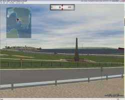
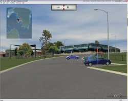
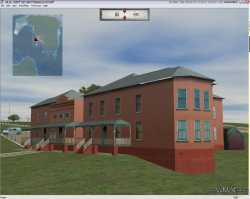
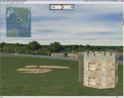
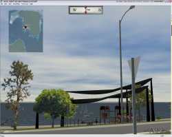
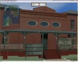
VizMAP was contracted by a Government Department to produce a 3D flythrough of the La Perouse headland in Botany Bay just south of Sydney. The visual database encompasses the 100 year old La Perouse Museum, the headland, fort, castellation, shops, houses – basically everything on the headland. The visualisation also extends across Botany Bay to incorporate land on the southern shore.
Click on these small resampled images to view the full screen images from the VizMAP website. Bear in mind that these are just screen dumps from a dynamic, interactive, 3D "flythrough".
If you would like more information on this project, or need your own similar project performed, let VizMAP know
|
| If you have a need to dynamically visualise your geographic data, let VizMAP know your requirements… |
Back to Top |
| EGOGRAM 2007 by Sir Arthur C. Clarke |
from NetworkWorld |
| The Golden Age of space travel is still ahead of us. Over the next 50 years, thousands of people will gain access to the orbital realm — and then, to the Moon and beyond, says Sir Arthur, 89.
Friends,Earthlings, ETs—lend me your sensory organs!
I send you greetings and good wishes at the beginning of another year. I’ll be celebrating (?) my 90th birthday in December—a few weeks after the Space Age completes its first half century.
When the late and unlamented Soviet Union launched Sputnik 1 on 4 October 1957, it took only about five minutes for the world to realise what had happened. And although I had been writing and speaking about space travel for years, the moment is still frozen in my own memory: I was in Barcelona attending the 8th International Astronautical Congress. We had retired to our hotel rooms after a busy day of presentations when the news broke—I was awakened by reporters seeking comments on the Soviet feat. Our theories and speculations had suddenly become reality!
Notwithstanding the remarkable accomplishments during the past 50 years, I believe that the Golden Age of space travel is still ahead of us. Before the current decade is out, fee-paying passengers will be experiencing sub-orbital flights aboard privately funded passenger vehicles, built by a new generation of engineer-entrepreneurs with an unstoppable passion for space (I’m hoping I could still make such a journey myself). And over the next 50 years, thousands of people will gain access to the orbital realm—and then, to the Moon and beyond.
During 2006, I followed with interest the emergence of this new breed of ‘Citizen Astronauts’ and private space enterprise. I am very encouraged by the wide-spread acceptance of the Space Elevator, which can make space transport cheap and affordable to ordinary people. This daring engineering concept, which I popularised in The Fountains of Paradise (1978), is now taken very seriously, with space agencies and entrepreneurs investing money and effort in developing prototypes. A dozen of these parties competed for the NASA-sponsored, US$ 150,000 X Prize Cup which took place in October 2006 at the Las Cruces International Airport, New Mexico.
The Arthur Clarke Foundation continues to recognise and cheer-lead men and women who blaze new trails to space. A few days before the X Prize Cup competition, my old friend Walter Cronkite received the Foundation’s Lifetime Achievement Award. I have known Walter for over half a century, and my commentary with him during the heady days of the Apollo Moon landings now belongs to another era. A space ‘pathfinder’ of the Twenty First Century, Bob Bigelow, was presented the Arthur C. Clarke Innovator Award for his work in the development of space habitats. With the successful launch of Bigelow Aerospace’s Genesis 1, Bob is leading the way for private individuals willing to advance space exploration with minimum reliance on government programmes.
|
| Read that full story here |
Back to Top |
| Whazzup Next – with 20/20 Foresight… |
| Check these sites for events to look out for in the Vis/Sim, GIS, LIS, Remote Sensing & Photogrammetry calendars… |
|
| |
Back to Top |
A Parting Gesture… |
| Abraham Lincoln and John F. Kennedy |
From Grime |
| Abraham Lincoln was elected to Congress in 1846. John F Kennedy was elected to Congress in 1946. Abraham Lincoln was elected President in 1860. John F. Kennedy was elected President in 1960. The names Lincoln and Kennedy each contain seven letters. Both were particularly concerned with civil rights. Both wives lost their children while living in the White House. Both Presidents were shot on a Friday. Both Presidents were shot in the head. Lincoln’s secretary was named Kennedy. Kennedy’s secretary was named Lincoln. Both were assassinated by Southerners. Both were succeeded by Southerners. Both successors were named Johnson. Andrew Johnson, who succeeded Lincoln, was born in 1808. Lyndon Johnson, who succeeded Kennedy, was born in 1908. John Wilkes Booth, who assassinated Lincoln, was born in 1839. Lee Harvey Oswald, who assassinated Kennedy, was born in 1939. Both assassins were known by their three names. Both names are comprised of fifteen letters. Booth ran from the theatre and was caught in a warehouse. Oswald ran from a warehouse and was caught in a theatre. Booth and Oswald were assassinated before their trials. And here’s the kicker… A week before Lincoln was shot, he was in Monroe, Maryland. A week before Kennedy was shot, he was in Marilyn Monroe |
 |
Back to Top |
|
VizMAP
Letting you see where you stand…
Feel free to forward this to whomsoever you wish.
To e-mail the VirtualGeography Editor, click here.
To subscribe to VirtualGeography, click here.
To unsubscribe from VirtualGeography, click here.
|
| |
…that’s all, folks. For now…
|
|
VizMAP
- Bureau & Services Portfolio
- Contact Us
- News
- Gladstone Port Access Road nearly complete after VizMAP visualisation convinces Council
- TerraTools Exporter for Virtual Battlespace 2 (VBS2) Now Available – 23/3/9
- Updated interactive “Flash Map” of Advanced Mining Projects in Queensland by VizMAP to be distributed to delegates of Mining 2006
- VizMAP & E2E deliver workshop at Queensland Spatial Conference, Brisbane, Queensland – 17/7/8
- VizMAP creates “virtual trek” to the Everest Base Camp
- VizMAP creates virtual coal mine for central Kalimantan
- VizMAP develops interactive “Flash Map” of Advanced Mining Projects in Queensland
- VizMAP imagery of Virtual Surat Energy Province awarded image of the month by Image Society Inc.
- VizMAP Launched
- VizMAP launches FlyLG: computer based geospatial Visualisation tailored to Australian local government areas
- VizMAP presents at Australia Pacific Spatial Innovation Conference 08, Canberra, ACT – 19/11/8
- VizMAP presents at GITA 07, Brisbane, Queensland – 8/8/7
- VizMAP presents at GITA Seminar, Darwin, Northern Territory – October, 2006
- VizMAP presents at Queensland Spatial Conference 2008, Brisbane, Queensland – 18/7/8
- VizMAP presents at Surveying and Spatial Sciences Institute (SSSI) Meeting, Hervey Bay
- VizMAP Presents TerraTours® Visualization at World Energy Congress
- VizMAP presents to Darling Downs Interest Group in GIS and Remote Sensing (DIGGARS) Seminar, USQ, Toowoomba, Queensland – 8/11/7
- VizMAP presents to International Map Trade Association (IMTA), Surfer’s Paradise, Queensland – 2/11/7
- VizMAP presents to Queensland Spatial Industry Council (QSIC), Brisbane, Queensland – 22/11/7
- VizMAP writes for Position Magazine – “The 3D Industry” – April-May 2007, No 28
- VizMAP’s Virtual Surat Energy Province
- VirtualGeography Index
- VizMAP
|


