vol 1 num 5

from VizMAP – letting you see where you stand…
Volume 1 – Number 5
|
| About VizMAP
VizMAP Pty Ltd, is a leading supplier of terrain Visualisation and related services to the defence, GIS, environmental, mapping, mining and exploration industries, engineering and construction firms, developers and planners, as well as government administration departments dealing with land, transportation and the environment.
VizMAP‘s products are designed to be run on reasonably to highly configured graphics computers (PC, Linux and Unix) for public display, group training, mission rehearsal, environmental monitoring, etc. and to enhance management decision making.
VizMAP is headquartered on Queensland’s Sunshine Coast (Australia) with affiliation in Asia, Europe, Africa and the USA and thereby provides support and services to customers worldwide.
If you need to visualise anything geographic, e-mail VizMAP here with the details.
For more information about VizMAP visit the VizMAP Web site at http://www.vizmap.com.au.
|
VirtualGeography
Subscription
Details
To subscribe to VirtualGeography,
click here.
To unsubscribe to VirtualGeography,
click here.
|
A Moment’s Notice
"Everyone else is envisioning a future of 32-bit deep bump-mapped lizard-skin scrollbars that adapt to the users mood by imperceptibly alpha-blending through a range of chromatic combinations not repeating in 3^18 years. Needs hardware acceleration, anaglyptic glasses, and 2 aspirin." — Phil Ehrens  |
|
VirtualGeography – the newsletter
|
| G’Day… and Welcome to VirtualGeography |
from VizMAP |
| Welcome to another free VirtualGeography from VizMAP Pty Ltd.
VirtualGeography is a collection of interesting snippets from all over the shop, dealing with industry issues concerning the computer based visualisation of geography and a few other associated (or otherwise) interesting bits and pieces. You are receiving this either because you subscribed to VirtualGeography or you have had recent dealings with VizMAP Pty Ltd. If you do not wish to receive further instalments of VirtualGeography, just click on the unsubscribe link at the bottom of this e-mail.
A new VirtualGeography is pushed out about once per month, towards the end of the month, which shouldn’t be too big a drain on your mailbox if you’re not already subscribed (of course it won’t be a drain on your mailbox if you ARE subscribed, either  ). If you know of anyone who might like to get VirtualGeography, feel free to forward this to them and ask them to subscribe. By the way, subscription and unsubscription details are at the bottom (click here). ). If you know of anyone who might like to get VirtualGeography, feel free to forward this to them and ask them to subscribe. By the way, subscription and unsubscription details are at the bottom (click here).
So, g’day to all you enthusiasts requiring to visualise and simulate both urban and rural geographic information (GIS), cartography, photogrammetry, remote sensing, digital elevation modelling (DEM) and general mapping.
|
By the spelling of "Visualisation" you may have already guessed that we’re not US based – that’s a good thing, or at least not a bad thing. This comes to you from Mooloolaba on the Sunshine Coast of Queensland, Australia, where it’s beautiful one day and perfect the next.
The link between visualisation and mapping may seem a little esoteric if this is your first encounter with this sort of stuff, but let me tell you, the bond is significant… but enough of that: on with the show… I hope you like it. Any feedback you might have is highly appreciated. E-mail me hereto make your comments.
Enjoy…
Graeme Brooke
VizMAP Pty Ltd
|
 |
P.S. You’ll need an active internet connection to view any images that are in the content. We’ve done it this way to keep the size of the e-mail to a minimum.
|
| |
Back to Top |
| The Industry’s Two Cents Worth… |
| Orad announces the world’s most powerful visual simulations platform |
from Orad |
| Kfar Saba, Israel, Orad Hi-Tec Systems announced that it has begun shipping the DVG, the world’s most powerful real time 3d graphics computer for visual simulation applications.
The DVG is composed of multiple nVidia’s GeForce 4 or ATI’s Radeon 9700 rendering units tied together to produce a single output channel. It has the best scalable graphical performance available on the market today. Any number of DVG nodes may be composed to address any level of scene complexity yielding unprecedented polygons count, fill rate and texture memory figures.
The DVG, using Commercial Off-The-Shelf graphical boards, has a most affordable price and can be easily upgraded with future generations of nVidia or ATI chips. It can be chained in any mix of four chaining modes (time division, image division, scene division and chaining for anti-aliasing) to scale performance according to the system’s critical resource. Orad provides porting services and software infrastructure for DVG users for civil and military simulations, urban planning, car design, engineering design reviews and many other applications.
|
| Read that full story here |
Back to Top |
| Hardcore Stuff (hardware bits)… |
| NVIDIA Extends Technology Leadership with Support for Intel Hyper-Threading |
from nVIDIA |
| Next-Generation NVIDIA Graphics Processors Poised to Deliver Highest-Levels of PC Performance on Desktop PCs with the Intel Pentium 4 Processor at 3.06 GHz
SANTA CLARA, CA — NOVEMBER 14, 2002 — NVIDIA Corporation (NASDAQ: NVDA), the worldwide leader in visual processing solutions, announced today that its next-generation graphics processors are poised to deliver higher levels of PC performance by taking advantage of Intel’s Hyper-Threading (HT) Technology on desktop PCs with the Intel Pentium(R) 4 processor at 3.06 GHz. The company has implemented support for HT Technology across its GeForce(tm) family of graphics processing units (GPU) to significantly elevate the level of graphics performance feasible on the PC platform.
"Modern graphics applications need all the CPU and GPU horsepower they can get," said Dan Vivoli, vice president of marketing at NVIDIA. "NVIDIA’s next-generation of GPUs take advantage of HT Technology to dramatically enrich the PC experience by providingthe ultimate platform for delivering video content, 3D games, digital photos, and DVD movies."
"As a leader in the graphics industry, we are pleased that NVIDIA has acknowledged and embraced HT Technology as a ground-breaking advancement for desktop PCs," said Jason Ziller, Technology Initiatives Manager at Intel. "With HT Technology, NVIDIA is able to deliver even higher levels of graphics performance to our customers."
|
| Read that full story here |
Back to Top |
| ATI’s industry-leading visual processors support Intel’s new Hyper-Threading(tm) technology |
from ATI |
| Revolutionary visual processor to power first public demonstration of Lejendary Adventure™ at COMDEX
Thursday, November 14, 2002
MARKHAM, Ontario – ATI Technologies Inc. (NASDAQ: ATYY, TSX: ATY) announced today that its industry-leading family of visual processing units (VPUs) are among the first graphics technologies to support Intel Corporation’s newly announced Hyper-Threading(tm) (HT) Technology featured in the newest 3.06GHz Pentium® 4 processor systems.
The RADEON(tm) 9700 visual processing unit (VPU) will be the first graphics card used to showcase HT Technology at COMDEX next week in Las Vegas, when Dreams Interactive unveils Lejendary Adventure(tm), its new online role-playing game (RPG). Most recently, at the Intel Developer Forum in September, Intel demonstrated Asheron’s Call 2 running simultaneously with time-shifting MPEG-2 video content through ATI’s All-in-Wonder RADEON(tm) 9700 PRO – the first time that high-quality, reliable gaming and clear time-shifting were possible at the same time on a PC.
In an exclusive agreement with Dreams Interactive, ATI’s RADEON 9700 PRO will be used with Intel’s new 3.06GHz HT-enabled processors to demonstrate the intricate detail and easy playability of the new RPG. Hyper-threading Technology – also featured in Intel’s newest chipsets, including the Intel 850E, 845GE, 845PE and 845GV – boosts performance by simulating the power of multiple processors on a single-processor machine. Lejendary Adventure was written specifically to take advantage of the additional performance provided by HT Technology.
"ATI and Intel have long worked together on graphics innovation," said Jason Ziller, Initiative Marketing Manager, Intel Corporation. "Recent tests with HT-enabled systems and the RADEON 9700 PRO show significantly more improvement through Hyper-Threading Technology, once again proving that ATI is a leader in graphics technology and cinematic quality. By choosing our new processor and ATI’s most powerful card to bring their game to life, Dreams Interactive has collaborated with the industry’s leaders."
|
| Read that full story here |
Back to Top |
| Softcore Stuff (software and data bits)… |
| TerraSim to Release New TerraTools Version 2.0 in February 2003 |
from TerraSim |
| TerraTools 2.0 adds a powerful suite of user interface capabilities allowing novices and experts alike to rapidly exploit GIS data, imagery, and models for high-fidelity realtime visualization.
New Features include:
- Increased Functionality and User Friendliness
- OmniWizard(tm)
- Full Coordinate System Support
- Process Flow Graph Simplification Tools: Macro Nodes
- New Import and Modeling Tools
- Improved Building Modeling Tools
- Increased Automation for Import Feature Data
- Enhanced Geometry and Terrain Data Import
- New Export and Inspection Tools
- Native CTDB export
- Still Frame Export for Movie Generation
- TSGfly Viewer Enhancements
Increased Functionality and User Friendliness
OmniWizard(tm):
The TerraTools OmniWizard provides both a flexible and powerful graphical interface for data import and inspection, and fully automated TerraTools project flow graph generation.
Full Coordinate System Support:
TerraTools now delivers extensive coordinate system, projection, and datum support with fully automated internal coordinate conversions. Input feature data, imagery, and models with disparate coordinate systems are ingested and converted to a common user selectable database build coordinate system. Support includes geodetic, UTM, state plane and projected grid systems.
Process Flow Graph Simplification Tools:
A new Macro Node capability allows users to collapse a set of nodes in the process graph into a single node, to simplify inspection and editing of TerraTools projects. Macro nodes can be opened, inspected, edited, and executed in exactly the same way as existing TerraTools nodes and graphs, delivering total control of the configuration of your TerraTools projects.
|
| Read that full story here |
Back to Top |
| ECSI |
from VizMAP |
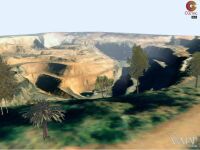
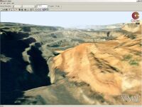
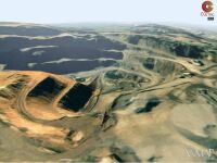
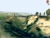
| VizMAP was recently contracted by ECSI in Bowral, New South Wales, to construct a Vis/Sim database for an existing open cut mine as a proof-of-concept demonstration.
Sample still images from the completed dynamic visualisation database are displayed here. An active internet connection is required to be able to view these scenes.
Click on these small resampled images to view the full screen images on the VizMAP website. Bear in mind that these are just screen dumps from a dynamic, interactive, 3D "flythrough".
|
| If you have a need to dynamically visualise your geographic data, let VizMAP knowyour requirements… |
Back to Top |
| DEC Designs Software to Help Catch the DC Sniper |
from Directions Magazine |
| Annapolis, MD — Digital Engineering Corporation (DEC) announces the release of ROADBlock Software, which was developed as a response to the Sniper spree in the Washington D.C. area. The software was designed to assist law enforcement officials in quickly closing off roads and exits routes immediately after the attacks. It was intended to play a key role in securing the area of each shooting.
President George W. Bush recently got a first hand look at the ROADBlock software. He, along with Homeland Security Advisor Tom Ridge and District of Columbia Mayor Anthony Williams, visited the D.C. Metropolitan Police Department’s Synchronized Operations Center. During their visit, Police Chief Charles Ramsey explained the center’s functions, which included the use of ROADBlock during the D.C. area Sniper Investigation.
Digital Engineering Corporation responded to the Sniper threat by contacting the team of law enforcement officials investigating the shootings. Fred Hejazi, president of DEC, volunteered free use of ROADBlock Software and free training to the Virginia State Police, Maryland State Police, and the District of Columbia Metropolitan Police.
ROADBlock was developed to aid police in quickly developing and implementing road closure plans. The user enters an address or road intersection near the shooting, and the software quickly maps the area. It provides the user with key information, like locations of schools, shopping centers, parks, and large facilities. It allows police to enter a perimeter distance around each incident, and, then compute the minimum number of road closures to "seal off" the area. It also displays a map detailing the most likely exit routes.
|
| Read that full story here |
Back to Top |
| Whazzup Next – with 20/20 Foresight… |
Stuff to look out for in December, January & February
| Legend |
| Included in last issue… |
| Updated since last issue… |
| New since last issue… |
|
This calendar of events has been collated from:
|
| December, 2002 |
| 2-3 December, 2002 |
Loan Workouts |
London, UK |
| 2-5 December, 2002 |
Interservice/Industry, Simulation and Education Conference (I/ITSEC) |
Orlando, Florida USA |
| 3 December, 2002 |
GITA Webcast: CIS/GIS/CRM – Maximizing your Customer Information with Integration to GIS |
USA |
| 3 December, 2002 |
DMTI Spatial Product Insight Seminars |
Markham, Ontario, Canada |
| 3-4 December, 2002 |
7th Polish Bank Congress |
Warsaw, Poland |
| 3-5 December, 2002 |
SIRC 2002 – ‘Physical and Cognitive Spaces’: 14th Annual Colloquium of the Spatial Information Research Centre |
Wellington, NZ |
| 3-5 December, 2002 |
Geobroadcasting 2002 |
Quebec City, Quebec Canada |
| 3-6 December, 2002 |
ISPRS International Symposium on Resource and Environmental Monitoring |
Hyderabad, India |
| 3-6 December, 2002 |
Autodesk University 2002 |
Las Vegas, Nevada USA |
| 5-6 December, 2002 |
Advanced Technology Licensing |
London, UK |
| 7-11 December, 2002 |
ISPRS The Council and Joint Meetings with Technical Commission Presidents |
Hyderabad, India |
| 8-11 December, 2002 |
Sixth Annual International Crime Mapping Research Conference |
Denver, Colorado USA |
| 11-12 December, 2002 |
Third Annual Geographic Imagery User Group Meeting |
Cambridge, UK |
| 12 December, 2002 |
Second International Workshop on Web and Wireless GIS 2002 |
Singapore |
| 12 December, 2002 |
WISE 2002 – 3rd International Conference on Web Information Systems Engineering |
Singapore |
| January, 2003 |
| 6-9 January, 2003 |
Coastal GeoTools ’03 |
Charleston, South Carolina USA |
| 7-10 January, 2003 |
PIERS 2003 Progress in Electromagnetics Research Symposium |
Singapore |
| 12-15 January, 2003 |
National Retail Federation Annual Convention & Expo |
New York, NY USA |
| 14 January, 2003 |
Product Insight Seminar – Census Demographic Products |
Markham, Ontario Canada |
| 20-24 January, 2003 |
Workshop of ISPRS WG V/2 "Videometrics VIII" IS&T/SPIE’s Symposium Electronics Imaging Science & Technology |
St.Clara, California USA |
| 21-23 January, 2003 |
WIRELESS POSITIONING & LBS 2003 |
San Francisco, California USA |
| 22-24 January, 2003 |
National Technical Meeting – The Institute of Navigation (ION) – 2003 |
Anaheim, CA USA |
| 27-28 January, 2003 |
Voice-Activated Services Summit |
London, UK |
| 27-29 January, 2003 |
10th international conference GIS "GIS Ostrava 2003" |
Ostrava, Czech Republic |
| 28-31 January, 2003 |
Map India 2003 |
New Delhi, India |
| 29-31 January, 2003 |
Miner & Miner User Group Meeting (MMUG) |
Ft. Collins, Colorado USA |
| February, 2003 |
| 4-6 February, 2003 |
VirtualGISCafe – "World’s First Virtual GIS Exhibit" |
USA |
| 4-6 February, 2003 |
DistribuTECH 2003 |
Las Vegas, NV USA |
| 10-11 February, 2003 |
Leveraged Finance Transactions |
London, UK |
| 11-14 February, 2003 |
5th Geomatic Week ‘Cartography, Telematics and Navigation’ |
Barcelona, Spain |
| 16-19 February, 2003 |
16th Geophysical Conference & Exhibition, Growth through innovation |
Adelaide, Australia |
| 16-22 February, 2003 |
12. Internationale Geodätische Woche |
Innsbruck, Austria |
| 24-28 February, 2003 |
ISPRS WG V/6 International Workshop on Visualization and Animation of Reality-based 3D Models |
Tarasp-Vulpera,
Switzerland |
| 25-28 February, 2003 |
CORP2003 & GeoMultimedia03 |
Vienna, Austria |
| 27-28 February, 2003 |
Indiana GIS 2003:Securing Our Future |
Indianapolis, IN USA |
|
| |
Back to Top |
| The Man in the Pub |
Not even closely "geographic" in nature from JokeADay (slightly amended) |
So a man walks into a pub and says, "Can I have an entendre, please?"
"Of course, sir," the bartender replies, "and would that be a single or a double?"
"Oh, make it a double."
"I see yours is a large one then, sir!" |
 |
Back to Top |

Feel free to forward this to whomsoever you wish.
To e-mail the VirtualGeography Editor, click here.
To subscribe to VirtualGeography, click here.
To unsubscribe to VirtualGeography, click here.
…that’s all, folks! (for now).
|
|
VizMAP
- Bureau & Services Portfolio
- Contact Us
- News
- Gladstone Port Access Road nearly complete after VizMAP visualisation convinces Council
- TerraTools Exporter for Virtual Battlespace 2 (VBS2) Now Available – 23/3/9
- Updated interactive “Flash Map” of Advanced Mining Projects in Queensland by VizMAP to be distributed to delegates of Mining 2006
- VizMAP & E2E deliver workshop at Queensland Spatial Conference, Brisbane, Queensland – 17/7/8
- VizMAP creates “virtual trek” to the Everest Base Camp
- VizMAP creates virtual coal mine for central Kalimantan
- VizMAP develops interactive “Flash Map” of Advanced Mining Projects in Queensland
- VizMAP imagery of Virtual Surat Energy Province awarded image of the month by Image Society Inc.
- VizMAP Launched
- VizMAP launches FlyLG: computer based geospatial Visualisation tailored to Australian local government areas
- VizMAP presents at Australia Pacific Spatial Innovation Conference 08, Canberra, ACT – 19/11/8
- VizMAP presents at GITA 07, Brisbane, Queensland – 8/8/7
- VizMAP presents at GITA Seminar, Darwin, Northern Territory – October, 2006
- VizMAP presents at Queensland Spatial Conference 2008, Brisbane, Queensland – 18/7/8
- VizMAP presents at Surveying and Spatial Sciences Institute (SSSI) Meeting, Hervey Bay
- VizMAP Presents TerraTours® Visualization at World Energy Congress
- VizMAP presents to Darling Downs Interest Group in GIS and Remote Sensing (DIGGARS) Seminar, USQ, Toowoomba, Queensland – 8/11/7
- VizMAP presents to International Map Trade Association (IMTA), Surfer’s Paradise, Queensland – 2/11/7
- VizMAP presents to Queensland Spatial Industry Council (QSIC), Brisbane, Queensland – 22/11/7
- VizMAP writes for Position Magazine – “The 3D Industry” – April-May 2007, No 28
- VizMAP’s Virtual Surat Energy Province
- VirtualGeography Index
- VizMAP
|


