| About VizMAP
VizMAP Pty Ltd, is a leading supplier of terrain Visualisation and related services to the defence, GIS, environmental, mapping, mining and exploration industries, engineering and construction firms, developers and planners, as well as government administration departments dealing with land, transportation and the environment.
VizMAP‘s products are designed to be run on reasonably to highly configured graphics computers (PC, Linux and Unix) for public display, group training, mission rehearsal, environmental monitoring, etc. and to enhance management decision making.
VizMAP is headquartered on Queensland’s Sunshine Coast (Australia) with affiliation in Asia, Europe, Africa and the USA and thereby provides support and services to customers worldwide.
If you need to visualise anything geographic, e-mail VizMAP here with the details.
For more information about VizMAP visit the VizMAP Web site at http://www.vizmap.com.au.
|
VirtualGeography
Subscription
Details
To subscribe to VirtualGeography,
click here.
To unsubscribe to VirtualGeography,
click here.
|
A Moment’s Notice
"Ever consider what dogs must think of us? I mean, here we come back from a grocery store with the most amazing haul – chicken, pork, half a cow. They must think we’re the greatest hunters on earth!" — Anne Tyler

|
|
VirtualGeography – the newsletter
|
| G’Day… and Welcome to VirtualGeography |
from VizMAP |
| Welcome to another free VirtualGeography from VizMAP Pty Ltd.
VirtualGeography is a collection of interesting snippets from all over the shop, dealing with industry issues concerning the computer based visualisation of geography and a few other associated (or otherwise) interesting bits and pieces. You are receiving this either because you subscribed to VirtualGeography or you have had recent dealings with VizMAP Pty Ltd. If you do not wish to receive further instalments of VirtualGeography, just click on the unsubscribe link at the bottom of this e-mail.
A new VirtualGeography is pushed out about once per month, towards the end of the month, which shouldn’t be too big a drain on your mailbox if you’re not already subscribed (of course it won’t be a drain on your mailbox if you ARE subscribed, either  ). If you know of anyone who might like to get VirtualGeography, feel free to forward this to them and ask them to subscribe. By the way, subscription and unsubscription details are at the bottom (click here). ). If you know of anyone who might like to get VirtualGeography, feel free to forward this to them and ask them to subscribe. By the way, subscription and unsubscription details are at the bottom (click here).
So, g’day to all you enthusiasts requiring to visualise and simulate both urban and rural geographic information (GIS), cartography, photogrammetry, remote sensing, digital elevation modelling (DEM) and general mapping.
|
By the spelling of "Visualisation" you may have already guessed that we’re not US based – that’s a good thing, or at least not a bad thing. This comes to you from Mooloolaba on the Sunshine Coast of Queensland, Australia, where it’s beautiful one day and perfect the next.
The link between visualisation and mapping may seem a little esoteric if this is your first encounter with this sort of stuff, but let me tell you, the bond is significant… but enough of that: on with the show… I hope you like it. Any feedback you might have is highly appreciated. E-mail me hereto make your comments.
Enjoy…
Graeme Brooke
VizMAP Pty Ltd
|
 |
P.S. You’ll need an active internet connection to view any images that are in the content. We’ve done it this way to keep the size of the e-mail to a minimum.
|
| |
Back to Top |
| The Industry’s Two Cents Worth… |
| Vis-sim.org |
from Vis-sim.org |
| What’s it all about?
Vis-sim.org is an unbiased resource for information about the Visual Simulation industry and community. It is a place to find software, hardware, technical info, data, and just about anything else you need to do vis-sim. It is also a place to interact with the Visual Simulation community; to talk to experts, developers, program managers, and others from all over the industry. Vis-sim.org also provides all the latest news and events pertaining to vis-sim.
Who owns/runs/operates vis-sim.org?
The site is not directly affiliated with or sponsored by any software vendor,hardware vendor, or contractor. Vis-sim.org is run by an independent group of vis-sim veterans, enthusiasts, and experts. We wish to provide a quality, useful, and more important of all, unbiased resource for the vis-sim community. Go here for more info.
What does vis-sim.org hope to accomplish?
Visual Simulation is a complex industry. One of the reasons it has remained such a "niche" is that entry into the vis-sim world is difficult. The technology is constantly changing, the learning curves are steep, and there are many players. Educating the customer is one of the hardest parts of selling products or services in this industry. With a community resource such as this, people can finally jump into the fray with the ability to make educated decisions when choosing products and services.
|
| Read that full story here |
Back to Top |
| Hardcore Stuff (hardware bits)… |
| Intel Pentium 4 3,06 GHz review |
from Guru3D |
| It was not really long ago, well weeks actually that we have tested the Pentium 4 2,8 GHz. While writing that review I of course already made note of the fact that the 3 GHz was on the way. Here we are, two weeks after the official announcement I receive a nice box with one mainboard, the seriously most dangerous active fan I have ever seen and of course a Pentium 3,06 GHz processor. The minute I unpacked I already knew that it had to be send back to Intel in two weeks .. wiping little tear from eye. Seriously, amazing .. I described the 2,8 GHz as a Ferrari well, we have a new one. My God, how fast this technology is evolving. This CPU is way ahead of everything your PC needs. We did a lot of tests and well .. even the Radeon 9700 Pro we used was simply a bottleneck in higher resolutions, not the processor.
This is the review of the Intel Pentium 3.06 GHz processor, and to date nothing can beat it. The press package came with PC1066 RDRAM, an awesome combination but also a very expensive one. We did it a bit different though, as I knew this processor would be submitted to us I asked the guys from Albatron to send in their best Pentium mainboard and they did. Combined with DDR400 memory we manage to produce breathtaking numbers for a very reasonable price with 100% stability.
There is something new in this CPU, you all know it, heard it and read about it so I will not waste too much time on it but of course this is Hyper-Threading technology.
Hyper-Threading is a very innovative technology that basically makes a single ‘normal’ processor appear as two "logical" processors. It does this by adding a certain two-way aproach in the core, therefore splitting the CPU’s resources managed by the operating system. According to Intel, this results in a performance increase in applications that are designed and implemented to take advantage of multi-threading, as well as applications using otherwise-idle CPU resources. Although a motherboard, BIOS, CPU and a capable operating system such as Windows XP is required to utilize Hyper-Threading, the 3.06GHz Pentium 4 is the first processor from Intel to support it, it will still operate in a non-HT system problem free, you just don’t have Hyper Threading enabled then.
|
| Read that full story here |
Back to Top |
| Softcore Stuff (software and data bits)… |
| SGI Delivers True Cross-Platform 3D Visualization for the Visual Simulation Community |
from SGI |
Friday December 20, 2:00 pm ET
OpenGL Performer 3.0 Provides Enhanced Performance and Quality for a Write Once, Deploy Anywhere Application
MOUNTAIN VIEW, Calif., Dec. 20 /PRNewswire-FirstCall/ — SGI (NYSE: SGI – News) today announced the OpenGL Performer(TM) 3.0 application programming interface (API) upgrade for the IRIX®, Linux® and Windows® operating systems.
OpenGL Performer(TM) is a powerful API for creating high-performance 3D graphics applications in visual simulation, styling, analysis and entertainment environments. The software simplifies the creation of high- performance applications by providing sophisticated visual effects, multiprocessor, multipipe and multidisplay management, unsurpassed real-time performance, and a diverse suite of tools and features spanning the spectrum of industries using interactive visualization. A unified interface supports IRIX, Linux and Windows development and run-time environments, delivering true cross-platform power and investment protection for real-time 3D markets.
"SGI is excited to open up its powerful OpenGL Performer 3D graphics visualization technology to the Windows PC world," said Susan Tellep, director of product marketing at SGI. "Now, applications based on OpenGL Performer can be written and developed on one platform and deployed on IRIX, Linux or Windows systems. The amazing power, scalability and realism provided by OpenGL Performer for real-time 3D graphics in visual simulation and other 3D performance-oriented applications like virtual reality, interactive entertainment, broadcast video and computer-aided design can help these applications improve their customers’ capabilities and choices."
|
| Read that full story here |
Back to Top |
| Introducing EP-1000CT: Unprecedented Realism at a Down-to-Earth Price |
from Evans and Sutherland |
| Lufthansa, KLM Choose New E&S Visual System
Designed especially to meet the exacting requirements of commercial aviation training, EPTM-1000CT is the first of a software-centered suite of products capable of running on a range of hardware platforms.
E&S has taken advantage of the best of COTS and in-house technology to develop a visual system that creates the highest fidelity and most cost-effective training environments in the world. EP-1000CT offers solutions to a number of critical training issues raised throughout the commercial aviation community.
Lufthansa Flight Training was the first airline to select E&S’s new EP-1000CT after 12 months of rigorous product demonstrations against key development milestones.
"The new EP system will greatly enhance our training capabilities," said Capt. Dieter Hensel of Lufthansa German Airlines. "The EP-1000CT systems provide the advances in training environment fidelity that today’s aviation industry demands, thereby increasing the safety of our passengers and crew."
Recent studies by agencies such as the International Air Transport Association (IATA) have cited the need for more realistic pilot training, particularly in the areas of approaches, landings, and severe weather scenarios. EP-1000CT improves pilot training by creating the most realistic training environments available today. In addition, there has long been a demand among airlines and training operators for faster and easier-to-generate databases. With EP-1000CT, databases can be generated or converted from other systems very quickly, sometimes in just a few hours.
|
| Read that full story here |
Back to Top |
| SPOT – Sydney |
from VizMAP |
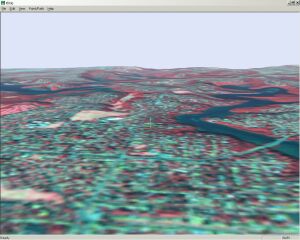
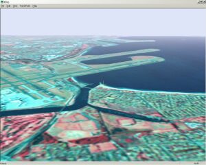
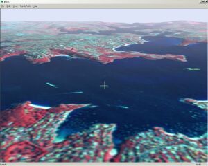
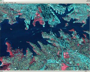
| VizMAP recently created a Vis-Sim database of Sydney, New South Wales, using SPOT 10m pan data colourised with SPOT Multispectral imagery.
Sample still images from the completed dynamic visualisation database are displayed here. An active internet connection is required to be able to view these scenes.
Click on these small resampled images to view the full screen images on the VizMAP website. Bear in mind that these are just screen dumps from a dynamic, interactive, 3D "flythrough".
|
| If you have a need to dynamically visualise your geographic data, let VizMAP knowyour requirements… |
Back to Top |
| Taking Tech Toys for a Spin |
from Wired News |
One of the hottest toys this season is Leap Frog’s Explorer Globe, an interactive globe that teaches and tests thousands of geographical facts.
Aimed at kids eight years of age and older, the $100 globe announces country names, oceans, continents and other geographic facts when touched with the attached pen.
The globe has two basic modes — learning and quizzing. A dial allows the child to choose between 10 learning modes. These different modes enable the child to learn the names of countries and continents, country population, music, currency, capital city and so on. The globe can also perform comparisons between two countries, such as relative size, or announce the distance between them.
Six quizzes test geographic knowledge, asking the child to find states, state capitols, countries, country capitals and continents. The child can play alone or with three other players. The level of difficulty can be adjusted.
The Explorer Globe is aimed at third-graders and up, and even the most basic quiz level was too challenging for our oldest child, Nadine, 6.
However, Nadine and her brother Milo, 5, enjoyed experimenting with the globe, finding different countries, states and cities. Though they both had some basic geographic knowledge, the globe has given them a sense of the world’s size and diversity, and after a few hours of play, both can find some countries and cities with ease.
At their ages, the Explorer Globe is a bit too sophisticated for Nadine and Milo, but its complexity means they have lots to learn from this toy as they grow older. |
| Read that full story here |
Back to Top |
| Whazzup Next – with 20/20 Foresight… |
Stuff to look out for in January, February & March
| Legend |
| Included in last issue… |
| Updated since last issue… |
| New since last issue… |
|
This calendar of events has been collated from:
|
| January, 2003 |
| 6-9 January, 2003 |
Coastal GeoTools ’03 |
Charleston, South Carolina USA |
| 7-10 January, 2003 |
PIERS 2003 Progress in Electromagnetics Research Symposium |
Singapore |
| 8-10 January, 2003 |
GIS India 2003 |
Jaipur, INDIA |
| 12-15 January, 2003 |
National Retail Federation Annual Convention & Expo |
New York, NY USA |
| 14 January, 2003 |
Product Insight Seminar – Census Demographic Products |
Markham, Ontario Canada |
| 20-24 January, 2003 |
Workshop of ISPRS WG V/2 "Videometrics VIII" IS&T/SPIE’s Symposium Electronics Imaging Science & Technology |
St.Clara, California USA |
| 21-23 January, 2003 |
WIRELESS POSITIONING & LBS 2003 |
San Francisco, California USA |
| 22-24 January, 2003 |
National Technical Meeting – The Institute of Navigation (ION) – 2003 |
Anaheim, CA USA |
| 23-24 January, 2003 |
Avenza Systems Training |
Orlando, FL USA |
| 23 & 25 January 2003 |
Winter GIS Training & Conference |
Dallas, TX USA |
| 24 January 2003 |
The Big Picture – Library Planning Using GIS |
Philadelphia, PA USA |
| 24-25 January 2003 |
California State University Fresno 42nd Annual Geomatics Engineering Conference |
Fresno, CA USA |
| 24-25 January 2003 |
MAPublisher training sessions |
Orlando, FL USA |
| 26-29 January, 2003 |
GIS OSTRAVA 2002: 10th International GIS Conference |
Ostrava-Poruba, Czech Republic |
| 27-28 January, 2003 |
Voice-Activated Services Summit |
London, UK |
| 27-28 January, 2003 |
THE INTERNATIONAL LIDAR MAPPING FORUM ANNUAL MEETING |
New Orleans, LA USA |
| 27-29 January, 2003 |
10th international conference GIS "GIS Ostrava 2003" |
Ostrava, Czech Republic |
| 27-31 January, 2003 |
GTC Southwest 2003 |
Austin, TX USA |
| 28-31 January, 2003 |
Map India 2003 |
New Delhi, India |
| 29-31 January, 2003 |
Miner & Miner User Group Meeting (MMUG) |
Ft. Collins, Colorado USA |
| 30-31 January, 2003 |
Portland Local Demographic Analysis Workshops |
Portland, Oregon USA |
| February, 2003 |
| 3 February, 2003 |
Commercial Loan and Security Documentation |
London, UK |
| 4 February, 2003 |
Successfully Documenting Syndicated Loan Transactions |
London, UK |
| 4-6 February, 2003 |
VirtualGISCafe – "World’s First Virtual GIS Exhibit" |
USA |
| 4-6 February, 2003 |
DistribuTECH 2003 |
Las Vegas, NV USA |
| 6-7 February, 2003 |
FME Training |
Vancouver, BC Canada |
| 10-11 February, 2003 |
Leveraged Finance Transactions |
London, UK |
| 10-11 February, 2003 |
Polish Power 2003 |
Warsaw, Poland |
| 11-12 February, 2003 |
Technology for Marketing |
Olympia, London, UK |
| 11-14 February, 2003 |
5th Geomatic Week ‘Cartography, Telematics and Navigation’ |
Barcelona, Spain |
| 12-13 February, 2003 |
SmartCard Alliance Mid-Winter Meeting & Educational Institute |
Salt Lake City, UT USA |
| 12-14 February, 2003 |
GeoCart 2003 |
Taupo, New Zealand |
| 16-19 February, 2003 |
The Australian Society of Exploration Geophysicists 16th Geophysical Conference and Exhibition "Growth Through Innovation" |
Adelaide, Australia |
| 16-22 February, 2003 |
12. Internationale Geodätische Woche |
Innsbruck, Austria |
| 17 February, 2003 |
NZ MapInfo User Conference |
Rotorua, New Zealand |
| 24-28 February, 2003 |
ISPRS WG V/6 International Workshop on Visualization and Animation of Reality-based 3D Models |
Tarasp-Vulpera,
Switzerland |
| 25-26 February, 2003 |
EURAN 2003 – International Symposium on European Radionavigation Networks – Integration of GPS, EGNOS, Galileo and LORANC/EUROFIX |
Bonn, Germany |
| 25-26 February, 2003 |
Run-Off and Commutations |
London, UK |
| 25 February – 1 March, 2003 |
CORP2003 & GeoMultimedia03 |
Vienna, Austria |
| 26 February, 2003 |
Copyright Directive |
London, UK |
| 26-27 February, 2003 |
Biotech Patenting |
London, UK |
| 27-28 February, 2003 |
Indiana GIS 2003:Securing Our Future |
Indianapolis, IN USA |
| 27-28 February, 2003 |
Trade Marks Conference |
London, UK |
| 27-28 February, 2003 |
FME Training |
Calgary, Alberta Canada |
| 28 February – 1 March, 2003 |
IMTA (EAME) Tenth Annual Conference and Trade Show |
Budapest, Hungary |
| March, 2003 |
| 1 March, 2003 |
Avenza Systems Training |
Budapest, Hungary |
| 1-5 March, 2003 |
California/Hawaii/Nevada/Guam-ESRI Regional Users’ Group |
Honolulu, Hawaii USA |
| 2-5 March, 2003 |
The Geospatial Information & Technology Association’s (GITA) Annual Conference |
San Antonio, Texas, USA |
| 3-5 March, 2003 |
Public Wireless Hotspots |
London, UK |
| 4-6 March, 2003 |
GEO-evenement 2003 |
Paris, France |
| 4-6 March, 2003 |
The International Direct Marketing Fair |
Earls Court 2, London UK |
| 4-8 March, 2003 |
99th Annual AAG 2003 Meeting |
New Orleans, LA USA |
| 6-7 March, 2003 |
Avenza Systems Training – MAPublisher training Sessions |
San Antonio, TX USA |
| 6-7 March, 2003 |
FME Training |
Houston, Texas USA |
| 16-19 March, 2003 |
GeoTec Event |
Vancouver, British Columbia, Canada |
| 17-18 March, 2003 |
Tennessee Geographic Information Council |
Nashville, TN USA |
| 17-19 March, 2003 |
CTIA WIRELESS 2003 |
New Orleans, LA USA |
| 17-21 March, 2003 |
34th Annual Lunar & Planetary Science Conference |
Houston, TX USA |
| 18 March, 2003 |
GEONorth 2003 |
Manchester, UK |
| 18 March, 2003 |
Galileo Industry Day |
Brussels, Belgium |
| 19-20 March, 2003 |
2nd International Symposium on Spatial Data Quality |
Hong Kong, China |
| 20-21 March, 2003 |
FME Training |
Vancouver, BC |
| 22 March, 2003 |
ISPRS WG IV/9 ET Mapping Workshop "Advances in Planetary Mapping 2003" |
Houston, TX USA |
| 24-26 March, 2003 |
Munich Satellite Navigation Summit 2003 |
Munich, Germany |
| 27 March, 2003 |
7th Annual Northeast Oregon Geographic Information System User Conference |
Pendleton, OR USA |
| 28-30 March, 2003 |
NSGIC 2003 Mid-Year Conference |
Denver, Colorado USA |
| 29 March – 2 April, 2003 |
ACSM 2003 |
Phoenix, Arizona, USA |
| 30 March – 1 April, 2003 |
Platts Global Power Market Conference |
New Orleans, LA USA |
| 30 March – 1 April, 2003 |
Integrating GIS & CAMA |
Columbus, OH USA |
|
| |
Back to Top |
| The Comfort Station |
Sort of "geographic" in nature from JokeADay (slightly amended) |
I left Brisbane heading toward Sydney, when I decided to stop at a comfort station. The first stall was occupied, so I went into the second one. I was no sooner seated than I heard a voice from the next stall: "Hi, how are you doing?"
Well, I am not the type to chat with strangers in highway comfort stations, and I really don’t know quite what possessed me, but anyway, I answered, a little embarrassed: "Not bad."
And the stranger said: "And, what are you up to?"
Talk about your dumb questions! I was really beginning to think this was too weird! So I said: "Well, just like you I’m driving south."
Then, I heard the stranger, all upset, say, "Look, I’ll call you back, there’s some idiot in the next stall answering all the questions I am asking you." |
 |
Back to Top |

Feel free to forward this to whomsoever you wish.
To e-mail the VirtualGeography Editor, click here.
To subscribe to VirtualGeography, click here.
To unsubscribe to VirtualGeography, click here.
…that’s all, folks! (for now).
|


