|
|
vol 3 num 1

from VizMAP – letting you see where you stand…
Volume 3- Number 1
|
| About VizMAP
VizMAP Pty Ltd, is a leading supplier of terrain Visualisation and related services to the defence, GIS, environmental, mapping, mining and exploration industries, engineering and construction firms, developers and planners, as well as government administration departments dealing with land, transportation and the environment.
VizMAP’s products are designed to be run on reasonably to highly configured graphics computers (PC, Linux and Unix) for public display, group training, mission rehearsal, environmental monitoring, etc. and to enhance management decision making.
VizMAP is headquartered on Queensland’s Sunshine Coast (Australia) with affiliation in Asia, Europe, Africa and the USA and thereby provides support and services to customers worldwide.
If you need to visualise anything geographic, e-mail VizMAP here with the details.
For more information about VizMAP visit the VizMAP Web site at http://www.vizmap.com.au.
|
VirtualGeography
Subscription
Details
To subscribe to VirtualGeography,
click here.
To unsubscribe to VirtualGeography,
click here.
|
A Moment’s Notice
"Everyone else is envisioning a future of 32-bit deep bump-mapped lizard-skin scrollbars that adapt to the users mood by imperceptibly alpha-blending through a range of chromatic combinations not repeating in 3^18 years. Needs hardware acceleration, anaglyptic glasses, and 2 aspirin." — Phil Ehrens |
|
VirtualGeography – the newsletter
|
| G’Day… and Welcome to VirtualGeography |
from here |
| Welcome to another free VirtualGeography from VizMAP Pty Ltd.
Better late than never, and from now on in a printer friendly format…
VirtualGeography is a collection of interesting snippets from all over the shop, dealing with industry issues concerning the computer based visualisation of geography and a few other associated (or otherwise) interesting bits and pieces. You are receiving this either because you subscribed to VirtualGeography or you have had recent dealings with VizMAP Pty Ltd. If you do not wish to receive further instalments of VirtualGeography, just click on the unsubscribe link at the bottom of this e-mail.
It is planned that a new VirtualGeography is pushed out every now and then when I’ve collated enough interesting bits and pieces, which shouldn’t be too big a drain on your mailbox if you’re not already subscribed (of course it won’t be a drain on your mailbox if you ARE subscribed, either  ). The regularity of the distribution may vary depending on what else is going on at VizMAP at the time. If you know of anyone who might like to get VirtualGeography, feel free to forward this to them and ask them to subscribe. By the way, subscription and unsubscription details are at the bottom (click here). ). The regularity of the distribution may vary depending on what else is going on at VizMAP at the time. If you know of anyone who might like to get VirtualGeography, feel free to forward this to them and ask them to subscribe. By the way, subscription and unsubscription details are at the bottom (click here).
So, g’day to all you enthusiasts requiring to visualise and simulate both urban and rural geographic information (GIS), cartography, photogrammetry, remote sensing, digital elevation modelling (DEM) and general mapping.
By the spelling of "Visualisation" you may have already guessed that we’re not US based – that’s a good thing, or at least not a bad thing. This comes to you from Mooloolaba on the Sunshine Coast of Queensland, Australia, where it’s beautiful one day and perfect the next.
|
The link between visualisation and mapping may seem a little esoteric if this is your first encounter with this sort of stuff, but let me tell you, the bond is significant… but enough of that: on with the show… I hope you like it. Any feedback you might have is highly appreciated. E-mail me here to make your comments.
Enjoy…
Graeme Brooke
VizMAP Pty Ltd
|
 |
P.S. You’ll need an active internet connection to view any images that are in the content. We’ve done it this way to keep the size of the e-mail to a minimum.
|
| |
Back to Top |
| The Industry’s Two Cents Worth… |
| TerraSim Awarded Phase II SBIR to develop DEM Fusion Technology |
from TerraSim |
| TerraSim, Inc. has been awarded a Phase II SBIR entitled "Automated Fusion of Digital Elevation Models" by the U.S. Army, to develop and commercialize technology allowing users of digital elevation models (DEMs) to merge multiple disparate sources of elevation data into consistent large area terrain models suitable for visualization, flood management planning, mission rehearsal and training, and large area mapping.
"We’re quite pleased and excited to have been selected for a Phase II award," said Dr. Chris McGlone, Director of Mapping and Civil Applications. "We believe that DEM fusion represents an important and challenging topic, given the need to accommodate DEMs derived from a wide variety of sources. Airborne LIDAR, the Shuttle Radar Topography Mission (SRTM), scanned maps, and photogrammetrically derived contours and grids all represent increasingly popular elevation data sources, and there is a strong government and commercial need for tools that
can merge arbitrary DEMs in a principled manner to generate DEM products with improved accuracy and precision."
"This award makes possible the development and commercialization of fast and robust DEM fusion tools, based on our Phase I efforts," remarked Dr. Jefferey A. Shufelt, principal investigator on the SBIR project. "We are pleased to continue our work with the U.S. Army Engineer and Research Development Center (ERDC-TEC) at Fort Belvoir, whose technical members have helped to focus our efforts."
|
| Read that full story here |
Back to Top |
| Hardcore Stuff (hardware bits)… |
| Boeing Slects Quantum3D Independence for Republic of Korea F-15K Distributed Mission Training System |
from Quantum3D |
| Quantum3D Independence IG Solutions Provides Open-Architecture, High-Fidelity, Multi-Channel Realtime Visual Computing Solution for Boeing F-15K DMT System
SAN JOSE, CALIF. – March 10, 2004 – Quantum3D®, Inc., a leading provider of open architecture, realtime 3D visual computing solutions for the Visual Simulation and Training (VST) and Embedded Visual Computing (EVC) markets, announced today that the Boeing Company (NYSE: BA) has selected Quantum3D Independence™ as the image generator (IG) solution for the F-15K Training System, which consists of a F-15K Weapon Systems Trainer (WST) and a Cockpit Procedures Trainer (CPT). The Training System is part of a contract recently awarded to Boeing by the Republic of Korea (ROK), in which the ROK will purchase 40 F-15K aircraft and associated equipment.
For each F-15K training system, Quantum3D will deliver two eleven-channel Independence IGs and spares to Boeing, which will be deployed to the ROK beginning in January 2005. The F-15K selection of Independence follows Boeing’s prior selection of Quantum3D IG Solutions for numerous flight and weapons system training programs including F-15E MTC, T-38 ATD, F-15 CTSS and F-15C DMT systems. For more information on the F-15K program, please visit http://www.boeing.com/news/releases/2002/q2/nr_020419m.html.
|
| Read that full story here |
Back to Top |
| Softcore Stuff (software and data bits)… |
| About GeoVRML |
from GeoVRML |
| GeoVRML is an official Working Group of the Web3D Consortium. It was formed on 27 Feb 1998 with the goal of developing tools and recommended practice for the representation of geographical data using the Virtual Reality Modeling Language (VRML). The desire is to enable geo-referenced data, such as maps and 3-D terrain models, to be viewed over the web by a user with a standard VRML plugin for their web browser.
The GeoVRML Working Group has a mailing list where discussions and developments are posted. Currently, this list consists of over 200 members drawn from a wide gamut of backgrounds and nationalities, including members from industry, government, and academia; geographers, geologists, computer graphics developers, and of course interested hobbyists.
The group has recently produced the GeoVRML 1.1 specification, providing a number of extensions to VRML for supporting geographic applications. There is also an accompanying Open Source Java sample implementation of these nodes. Finally, these nodes are part of Amendment 1 to the VRML97 ISO standard.
|
| Read that full story here |
Back to Top |
| Brisbane Flood |
from VizMAP |
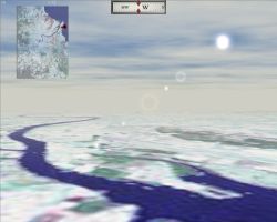
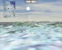
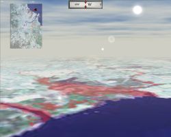
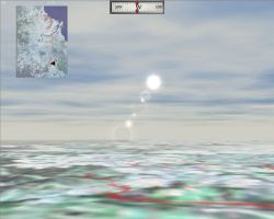
| VizMAP recently performed an exercise using Landsat imagery over the Brisbane region to show flood regions (shown in transparent red). TerraTools 2.0 from TerraSim was used to create the vis/sim database. The viewer used here was TerraSim’s new TSGFly version 3.0. New functionality added to TSGFly 3.0 is the incorporation of an overview map, a compass, a skydome complete with moving clouds and sun position with lens flare.
Sample still images from the completed dynamic visualisation database are displayed here. An active internet connection is required to be able to view these scenes.
Click on these small resampled images to view the full screen images on the VizMAP website. Bear in mind that these are just screen dumps from a dynamic, interactive, 3D "flythrough". |
| If you have a need to dynamically visualise your geographic data, let VizMAP know your requirements… |
Back to Top |
| FutureFlight Central Goes to Mars! |
from NASA |
| A new Mars database using 3D images from the Mars Exploration Rovers (MER) mission will be installed in FutureFlight Central in the near future. Digital stereo images now being transmitted from the rover Spirit will be processed by VIZ, a software tool developed by NASA Ames, and displayed in FutureFlight’s 360-degree projection environment. VIZ is the same visualization tool used at the Jet Propulsion Laboratory (JPL) to support the operational mission.
FutureFlight will enable a unique 360-degree out-the-window visualization of Mars. The view will be based on the rover’s perspective but viewers can adopt other perspective and thus effectively move through the scene. This ability to smoothly navigate through the scene provides a three dimensional sense and an immediate visceral understanding of the remote environment.
The new database will be of higher fidelity than previously available from the Mars Pathfinder landing site; the stereo color images from the rover, Spirit, are of higher resolution and these images will be combined in the new database with high-resolution images from the Mars Global Surveyor orbiter.
The panoramic presentation of images acquired by the rover can provide mission scientists an improved situational and positional awareness of the rover in its remote environment. This is in contrast to what is provided now: an elongated hard copy print, stereo images viewed through red/green spectacles or a series of TV monitor presentations.
|
| Read that full story here |
Back to Top |
| Whazzup Next – with 20/20 Foresight… |
Stuff to look out for in March, April, May & June
| Legend |
| Included in last issue… |
| Updated since last issue… |
| New since last issue… |
|
This calendar of events has been collated from:
|
| March 2004 |
| March 1 – 2 |
Biotech Patenting |
Munich, Germany |
| March 1 – 4 |
Third European Geosynthetics Conference, EuroGeo 3: Geotechnical Engineering with Geosynthetics |
Munich, Germany |
| March 2 |
GITA (Regional Workshop) |
Auckland, NZ |
| March 2 – 5 |
SATELLITE 2004 |
Washington DC, USA |
| March 3 |
6th Annual Southern African MapInfo User Conference |
Sandton, South Africa |
| March 3 – 5 |
Wisconsin Land Information Association Annual Conference |
Wisconsin Dells,Wisconsin, USA |
| March 3 – 5 |
INTERGEO-EAST |
Belgrade, Serbia and Montenegro |
| March 7 – 10 |
EARTH & SPACE 2004 – 9th Biennial International |
League City, Texas USA |
| March 9 – 10 |
UK Crime Mapping Conference |
London, United Kingdom |
| March 11 – 12 |
FME Training Course |
Surrey, British Columbia, Canada |
| March 13 – 18 |
EuroConference on Methods to Support Interaction in Geovisualisation Environments |
Kolymbari, Crete, Greece |
| March 14 – 19 |
AAG Centennial Meeting |
Philadelphia, PA USA |
| March 15 – 16 |
Export Controls |
London, UK |
| March 15 – 19 |
14th International Conference on Engineering Surveying |
Zurich, SWITZERLAND |
| March 16 |
GeoNorth |
Manchester, UK |
| March 17 – 18 |
GIS Connecting Communities – The 12th MAC-URISA Regional GIS |
Piscataway, NJ USA |
| March 22 – 23 |
Seventeenth Annual Geographic Information Sciences Conference – TUGIS 2004 |
Towson, MD USA |
| 23-24 March |
Web Enabled GIS Strategies Conference 2004 |
Sydney, NSW, Australia |
| March 23 – 25 |
A Joint GOFC/GOLD Fire and CEOS LVP Workshop "Global Geostationary Fire Monitoring Applications" |
Darmstadt, GERMANY |
| March 24 |
GIS Tech 2004 |
Rotterdam, The Netherlands |
| March 24 – 25 |
APAS (Association of Public Authority Surveyors) Conference |
The Entrance, NSW |
| March 26 |
Wireless GIS and Location Based Services |
Bristol, United Kingdom |
| March 26 – 28 |
NSGIC Midyear Conference |
Reston, VA, USA |
| March 28 – 31 |
Integrating GIS & CAMA Conference |
Austin, TX USA |
| March 28 – 31 |
The GeoTec Event — Pathways to Integration |
Toronto, Ontario, Canada |
| March 28 – 31 |
GIS-T |
Rapid City, South Dakota, USA |
| March 28 – April 1 |
Water: Planning for the Future (Australian Water Association, part of Enviro 04) |
Sydney, NSW Australia |
| March 28 – April 1 |
Enviro 04 |
Sydney, NSW Australia |
| March 29 – 31 |
4th International Symposium on Mobile Mapping Technology |
Kunming, China |
| March 29 – April 1 |
20th National Space Symposium |
Colorado Springs, CO USA |
| March 30 |
MapWorld User Forums |
Perth, WA Australia |
| March 31 – April 2 |
8th International Symposium on 3-D Analysis of Human Movement |
Tampa, Florida, USA |
| April 2004 |
| 1 April |
MapWorld User Forums |
Canberra, ACT Australia |
| 1-2 Apr 2004 |
RSPSoc Annual Student Meeting 2004 |
Edinburgh, Scotland, UK |
| 1-2 Apr 2004 |
FME Training Course |
Toronto ON Canada |
| 3-8 April |
South Central Arc User Group Conference |
Irving, TX USA |
| 5 April |
MapWorld User Forums |
Brisbane, Qld, Australia |
| 5 April |
MapWorld User Forums |
Hobart, Tas, Australia |
| 6 April |
MapWorld User Forums |
Sydney, NSW Australia |
| 7 April |
MapWorld User Forums |
Melbourne, Vic Australia |
| 12-16 April |
APS April Meeting 2004 |
Orlando, FL USA |
| 13-14 April |
Tennessee Geographic Information Council Annual Conference |
Franklin, TN USA |
| 14-16 April |
14th Annual Nevada NGIS Conference |
Las Vegas, NV USA |
| 15 Apr |
Basic GIS Coordinates Seminar |
Springfield, Illinois USA |
| 15 Apr |
GO! Sync for ArcPad Webinar |
WWW |
| 15-16 Apr |
FME Training Course |
Denver, CO USA |
| 15-16 Apr |
ESRI Regional User Conference |
Calgary, AB Canada |
| 15-17 Apr 2004 |
International Symposium on Spatial Data Quality
ISSDQ 2004 |
Bruck an der Leitha, AUSTRIA |
| 16-21 Apr 2004 |
ACSM-TAPS 2004 Annual Conference and Technology Exhibition |
Nashville, TN USA |
| 18-22 Apr 2004 |
2004 MidAmerica GIS Symposium (MAGIC) |
Kansas City, Missouri USA |
| 19-23 Apr |
2004 INTERMOUNTAIN GIS CONFERENCE |
Billings, MT USA |
| 20 Apr 2004 |
Wireless China 2004 Roadshow |
Shanghai, China |
| 20 Apr 2004 |
Delaware GIS 2004 Conference |
Dover, Delaware USA |
| 21-23 Apr 2004 |
MeCEO 2004
1st Mediterranean Conference on Earth Observation (Remote Sensing) |
Belgrade, SERBIA-MONTENEGRO |
| 21-23 Apr |
FL Joint Mapping Conference |
Daytona Beach, FL USA |
| 22 Apr 2004 |
Wireless China 2004 Roadshow |
Chengdu, China |
| 22 Apr 2004 |
MapWorld 2004 |
Toronto, Canada |
| 23-24 April |
Inaugural Queensland SSI Conference: Queensland Spatial Information Infrastructure Council (QSIIC) in association with SSI |
Brisbane, Qld Australia |
| 24-28 April |
APA National Planning Conference |
Washington, D.C., USA |
| 25-28 April |
27th Annual GITA |
Seattle, WA US |
| 25-30 Apr 2004 |
European Geosciences Union 1st General Assembly |
Nice, FRANCE |
| 27 Apr 2004 |
Wireless China 2004 Roadshow |
Shenzhen, China |
| 28-29 Apr |
FME Training Course |
Brisbane Qld Australia |
| May 2004 |
| 3-4 May |
ESRI Regional User Conference – North Bay |
North Bay, ON Canada |
| 4 May |
ESRI – Solutions for Local Government |
Melbourne, Vic Australia |
| 4-6 May |
ExpoGPS 2004: 1st International GPS Technology Congress and Exhibition |
São Paulo, Brazil |
| 4-6 May |
GEOBrazil 2004: 5th Annual International Conference on GeoInformation |
São Paulo, Brazil |
| 4-7 May |
International Workshop on Administrating the Marine Environment – the Spatial Dimensions; PCGIAP – Working Group 3 |
Kuala Lumpur, Malaysia |
| 5-7 May |
Land Development Conference & Expo 2004 |
Baltimore, MD USA |
| 5-7 May |
Impacts of Improving the Positional Accuracy of GI Databases |
Dublin, Ireland |
| 6-7 May |
FME Training Course |
Surrey, BC Canada |
| 10-11 May 2004 |
Location Technology & Business Intelligence Executive Symposium |
Philadelphia, PA, USA |
| 10-14 May 2004 |
IV International Congress GEOMATICA 2004 "Geospatial Technology: Trends and Opportunities" |
Havana, CUBA |
| 11-12 May |
Twelfth Annual Pennsylvania GIS Conference |
Harrisburg, PA USA |
| 12 May |
MapWorld User Forums |
Darwin, NT Australia |
| 12-13 May |
ESRI – Solutions for Local Government |
Gold Coast, Qld Australia |
| 12-13 May |
FME Training Course |
Sydney, NSW Australia |
| 12-14 May |
Geospatial World 2004 (Intergraph Users Conference) |
Miami Beach Florida |
| 12-14 May |
GTC West |
Sacramento, CA USA |
| 14-15 May |
2004 Mapping the News Conference |
Washington, D.C., USA |
| 17-18 May |
ESRI Regional User Conference – London |
London, ON, Canada |
| 17-20 May |
2004 URISA Caribbean GIS Conference |
Jamaica |
| 19-20 May |
Geographic Information System (GIS) Symposium – Troy State |
Troy, AL, USA |
| 19-21 May |
CgA World Conference 2004 |
Mumbai, India |
| 20-21 May |
FME Training Course |
Atlanta, GA USA |
| 22-27 May 2004 |
FIG Working Week 2004 "The Olympic Spirit in Surveying" |
Athens, GREECE |
| 23-27 May 2004 |
Bentley International User Conference |
Orlando, FL, USA |
| 24-27 May 2004 |
SimTecT 2004, Simulation – Better Than Reality? Simulation Industry Association of Australia |
Canberra, ACT Australia |
| 24-28 May 2004 |
ASPRS Annual Conference |
Denver, CO USA |
| 25 May |
MapInfo Benelux Conference 2004 |
Ede, Netherlands |
| 25-27 May 2004 |
24th EARSeL Symposium
"New Strategies for European Remote Sensing" |
Dubrovnik, CROATIA |
| 26-27 May |
FME Training Course |
Auckland, New Zealand |
| 28-29 May 2004 |
EARSeL SIG Workshop on "Remote Sensing of Land Use and Land Cover" |
Dubrovnik, CROATIA |
| 31 May-1 June |
GIS for Emergency Management |
Sydney, NSW Australia |
| June 2004 |
| 1 June |
GITA (Regional Workshop) |
Brisbane, Qld Australia |
| 7-9 June 2004 |
12th International Conference on Geoinformatics Geospatial Information Research: Bridging the Pacific and Atlantic |
Gavle, Sweden |
| 9-10 June |
FME Training Course |
Canberra, ACT Australia |
| 10 June |
MapWorld 2004 |
Chicago, Illinois, USA |
| 9-11 June |
Open Source GIS Conference 2004 and Second Annual MapServer User Meeting |
Ottawa, Canada |
| 10-11 June |
FME Training Course |
Surrey, BC Canada |
| 20-23 June 2004 |
ISPRS IC WG II/IV
97th Annual Canadian Institute of Geomatics Conference |
Ottawa, CANADA |
| 23-24 June |
FME Training Course |
Melbourne, Vic Australia |
| 23-24 June |
ESRI Regional User Conference – Penticton |
Penticton, BC, Canada |
| 23-25 June 2004 |
EOGEO 2004 Workshop for developers of Geospatial data services over the Web |
London, UK |
| 23-25 June 2004 |
European Commission – GI & GIS Workshop |
Warsaw, Poland |
| 24 June |
MapWorld 2004 |
San Francisco, CA USA |
| June 28 – 29, 2004 |
ESRI GeoInfo Summit |
Chicago, IL USA |
|
| |
Back to Top |
A Parting Gesture… |
| Rice Bush |
From Grime |
We take you now to the Oval Office where President Bush is meeting with National Security Advisor Condolezza Rice:
George: Condi! Nice to see you. What’s happening?
Condi: Sir, I have the report here about the new leader of China.
George: Great. Lay it on me.
Condi: Hu is the new leader of China.
George: That’s what I want to know.
Condi: That’s what I am telling you.
George: That’s what I’m asking you. Who is the new leader of China?
Condi: Yes.
George: I mean the fellow’s name.
Condi: Hu.
George: The guy in China.
Condi: Hu.
George: The new leader of China.
Condi: Hu.
George: The Chinaman!
Condi: Hu is leading China.
George: Now whaddya asking me for?
Condi: I’m not asking, I’m telling you Hu is leading China.
George: Well, I’m asking you. Who is leading China?
Condi: That’s the man’s name, sir.
George: That’s who’s name?
Condi: Yes.
George: Will you or will you not tell me the new leader of China?
Condi: Yes, sir.
George: Yassir? Yassir Arafat is in China? I thought he was in the Middle East.
Condi: That’s correct.
George: Then who is in China?
Condi: Yes, sir.
George: Yassir is in China?
Condi: No, sir.
George: Then who is?
Condi: Yes, sir.
George: Yassir?
Condi: No, sir.
George: Look, Condi. I need to know the name of the new leader of China. Get me the Secretary General of the U.N. on the phone.
Condi: Kofi?
George: No, thanks.
Condi: You want Kofi?
George: No.
Condi: You don’t want Kofi?
George: No, But now that you mention it, I could use a glass of milk. And then get me the U.N.
Condi: Yes, sir.
George: Not Yassir! The guy at the U.N.
Condi: Kofi?
George: Milk! Will you please make the call.
Condi: And call who?
George: Who is the guy at the U.N.?
Condi: Hu is the guy in China.
George: Will you stay out of China?!
Condi: Yes, sir.
George: And stay out of the Middle East! Just get me the guy at the U.N.
Condi: Kofi.
George: All right! With cream and two sugars. Now get on the phone.
(Condi picks up the phone) Rice, here.
George: Rice? Good idea. And a couple of egg rolls, too. Maybe we should send some to the guy in China. And the Middle East. Can you get Chinese food in the Middle East? |
 |
Back to Top |
|
Feel free to forward this to whomsoever you wish.
To e-mail the VirtualGeography Editor, click here.
To subscribe to VirtualGeography, click here.
To unsubscribe to VirtualGeography, click here. |
| |
…that’s all, folks! (for now).
|
|
VizMAP
- Bureau & Services Portfolio
- Contact Us
- News
- Gladstone Port Access Road nearly complete after VizMAP visualisation convinces Council
- TerraTools Exporter for Virtual Battlespace 2 (VBS2) Now Available – 23/3/9
- Updated interactive “Flash Map” of Advanced Mining Projects in Queensland by VizMAP to be distributed to delegates of Mining 2006
- VizMAP & E2E deliver workshop at Queensland Spatial Conference, Brisbane, Queensland – 17/7/8
- VizMAP creates “virtual trek” to the Everest Base Camp
- VizMAP creates virtual coal mine for central Kalimantan
- VizMAP develops interactive “Flash Map” of Advanced Mining Projects in Queensland
- VizMAP imagery of Virtual Surat Energy Province awarded image of the month by Image Society Inc.
- VizMAP Launched
- VizMAP launches FlyLG: computer based geospatial Visualisation tailored to Australian local government areas
- VizMAP presents at Australia Pacific Spatial Innovation Conference 08, Canberra, ACT – 19/11/8
- VizMAP presents at GITA 07, Brisbane, Queensland – 8/8/7
- VizMAP presents at GITA Seminar, Darwin, Northern Territory – October, 2006
- VizMAP presents at Queensland Spatial Conference 2008, Brisbane, Queensland – 18/7/8
- VizMAP presents at Surveying and Spatial Sciences Institute (SSSI) Meeting, Hervey Bay
- VizMAP Presents TerraTours® Visualization at World Energy Congress
- VizMAP presents to Darling Downs Interest Group in GIS and Remote Sensing (DIGGARS) Seminar, USQ, Toowoomba, Queensland – 8/11/7
- VizMAP presents to International Map Trade Association (IMTA), Surfer’s Paradise, Queensland – 2/11/7
- VizMAP presents to Queensland Spatial Industry Council (QSIC), Brisbane, Queensland – 22/11/7
- VizMAP writes for Position Magazine – “The 3D Industry” – April-May 2007, No 28
- VizMAP’s Virtual Surat Energy Province
- VirtualGeography Index
- VizMAP
|


