|
|
vol 4 num 2

from VizMAP – letting you see where you stand…
Volume 4 Number 2
|
| About VizMAP
VizMAP Pty Ltd, is a leading supplier of terrain Visualisation and related services to the defence, GIS, environmental, mapping, mining and exploration industries, engineering and construction firms, developers and planners, as well as government administration departments dealing with land, transportation and the environment.
VizMAP’s products are designed to be run on reasonably to highly configured graphics computers (PC, Linux and Unix) for public display, group training, mission rehearsal, environmental monitoring, etc. and to enhance management decision making.
VizMAP is headquartered on Queensland’s Sunshine Coast (Australia) with affiliation in Asia, Europe, Africa and the USA and thereby provides support and services to customers worldwide.
If you need to visualise anything geographic, e-mail VizMAP here with the details.
For more information about VizMAP visit the VizMAP Web site at http://www.vizmap.com.au.
|
VirtualGeography
Subscription
Details
To subscribe to VirtualGeography,
click here.
To unsubscribe from VirtualGeography,
click here.
|
A Moment’s Notice
"Knowledge is limited. Imagination encircles the world.
–– Albert Einstein |
|
VirtualGeography – the newsletter
|
| G’Day… and Welcome to VirtualGeography |
from here |
| Welcome to another free VirtualGeography from VizMAP Pty Ltd.
VizMAP has been going gangbusters in the past few months with significant contracts with Electranet SA and Queensland Government, as well as a raft of smaller gigs ranging from a broadscale visualisation of south east Queensland to a look at the Murray River in South Australia to a number of presentations at regional seminars in the, well, region. Did I mention that VizMAP got "Image of the Month" last November from the Image Society, Inc. – a non-profit, technical, professional association for the advancement of visual simulation. The image of the month for November 2004, of the Surat project, can be viewed here.
If you didn’t already know, VirtualGeography is a collection of interesting snippets from all over the shop, dealing with industry issues concerning the computer based visualisation of geography and a few other associated (or otherwise) interesting bits and pieces. You are receiving this either because you subscribed to VirtualGeography or you have had recent dealings with VizMAP Pty Ltd. If you do not wish to receive further instalments of VirtualGeography, just click on the unsubscribe link at the bottom of this e-mail.
It is planned that a new VirtualGeography is pushed out every now and then when we’ve collated enough interesting bits and pieces, which shouldn’t be too big a drain on your mailbox if you’re not already subscribed (of course it won’t be a drain on your mailbox if you ARE subscribed, either  ). The regularity of the distribution may vary depending on what else is going on at VizMAP at the time. If you know of anyone who might like to get VirtualGeography, feel free to forward this to them and ask them to subscribe. By the way, subscription and unsubscription details are at the bottom (click here). ). The regularity of the distribution may vary depending on what else is going on at VizMAP at the time. If you know of anyone who might like to get VirtualGeography, feel free to forward this to them and ask them to subscribe. By the way, subscription and unsubscription details are at the bottom (click here).
So, g’day to all you enthusiasts requiring to visualise and simulate both urban and rural geographic information (GIS), cartography, photogrammetry, remote sensing, digital elevation modelling (DEM) and general mapping.
By the spelling of "Visualisation" you may have already guessed that we’re not US based – that’s a good thing, or at least not a bad thing. This comes to you from Mooloolaba on the Sunshine Coast of Queensland, Australia, where it’s beautiful one day and perfect the next. As a postscript to that, you can have a look at the Mooloolaba beach, now, 800m from where I sit as I write this, here.
|
The link between visualisation and mapping may seem a little esoteric if this is your first encounter with this sort of stuff, but let me tell you, the bond is significant… but enough of that: on with the show… I hope you like it. Any feedback you might have is highly appreciated. E-mail me here to make your comments.
Enjoy…
Graeme Brooke
VizMAP Pty Ltd
|
 |
P.S. You’ll need an active internet connection to view any images that are in the content. We’ve done it this way to keep the size of the e-mail to a minimum.
|
| |
Back to Top |
| The Industry’s Two Cents Worth… |
| VizMAP Launches FlyLG – Geospatial Visualisation for Australian Local Government |
from VizMAP |
| The series of 3D databases, collectively known as FlyLG, combine orthorectified 25m Landsat satellite imagery and a 9 arc second (~250m) digital terrain model (DTM) to produce a realistic, broad scale, interactive "flythrough" of individual local government areas.
Local government areas in the FlyLG range are individually available from VizMAP at a single fixed cost and are each built using the state-of-the-art TerraTools virtual environment software package from TerraSim Inc. (PA, USA).
Each FlyLG package enables the user to sit at their computer and interactively fly, drive or walk around their local government area in real-time by simply using a mouse. FlyLG visualisations run in full screen or windowed mode with the user able to control such aspects as sky colour, overview map, compass, clouds, sun position, lens flare, fog and much more.
As well as interactively flying around the scenery, users can also create an unlimited number of "jump points" and fixed flight paths enabling hands-free navigation through the region.
Graeme Brooke, the owner and manager of VizMAP, said today, "VizMAP is the reseller in Australia and New Zealand for TerraTools, but often the end-users of TerraTools’ output don’t have the resources, requirement or budget for an in-house facility to build these complex 3D databases. Such is the case for the typical local authority. Some are big enough to warrant it, but we’ve targeted FlyLG at those who are not".
"FlyLG databases will be particularly useful in local government for such things as simple flood modelling, development planning, public display and community consultation. Also, one of the major benefits of FlyLG is that it is distributed with a license-free viewer enabling the local government to copy the deliverable CD and give it away to their ratepayers, if they want to", he said.
The President of TerraSim Inc., Dave McKeown said from Pittsburgh, "VizMAP is TerraSim’s exclusive value added reseller (VAR) in Australia and New Zealand for its TerraTools® and TerraTours® product line. Beyond direct sales and customer support, Mr. Brooke has supported our product by performing extensive service bureau work using TerraTools and our TSGFly(TM) and TerraTours viewers. Graeme’s visualization portfolio is impressive. In terms of breadth and scope of projects, ranging from a detailed urban railway project to the highly interactive Surat Basin visualization project spanning hundreds of miles, I know of no other non-military end user who has completed such ambitious projects using our software. We wish him well in this new initiative".
|
| Read that full story here |
Back to Top |
| Hardcore Stuff (hardware bits)… |
| NVIDIA Scalable Visualization Solutions Deliver Tenfold Performance Increase |
from nVidia |
| NVIDIA Quadro® Genlock/Framelock Solutions Enable Advanced Visualization Applications at a Fraction of the Cost of Current Solutions.
SANTA CLARA, CA – APRIL 19, 2005 – NVIDIA Corporation (Nasdaq: NVDA), a worldwide leader in graphics and digital media processors, today announced the immediate availability of the NVIDIA Quadro G-Sync option board, complementing current genlock and framelock solutions. This latest solution, that connects to the NVIDIA Quadro FX 4400, delivers even higher performance, scalability, features, and upgradeability to current visualization and broadcast customers who already leverage the benefits of commercial of the shelf (COTS) graphics.
Data from NVIDIA customers, such as the BP Center for Visualization, is a testament to the performance and capabilities of these solutions. BP Center for Visualization engineers integrated the NVIDIA Quadro FX 3000G into their oil exploration visualization systems after an extensive economic and performance analysis. The findings have been nothing short of exceptional with the center realizing a dramatic improvement in visualization performance, coupled with an order of magnitude reduction in system costs.
"We’ve been powering our Immersive Virtual Reality environment using NVIDIA hardware since the introduction of the genlock boards in 2003", said Jonathan Marbach of the BP Center for Visualization. "Compared to our previous solution, I’ve seen a 10x¹ increase in triangle throughput and a 5x increase in frame rate for our Immersive Drilling Planner application. The new G-Sync option board works with the latest PCI Express graphics, so we expect to see another dramatic performance boost from the latest generation of hardware. High frame rates are absolutely critical for Virtual Reality, and NVIDIA hardware allows us to keep up with our users and their data.”
The G-Sync option board offers (two) RJ-45 and (one) genlock BNC connectors and brings a new level of flexibility, allowing users to upgrade to the latest graphics solutions as they become available. The NVIDIA Quadro FX 4400 features two high definition digital display outputs and a stereo connector. The combined solution offers 512MB G-DDR3 ultra-fast memory and offers dual dual-link support which allows the user to drive up to two 9 megapixel panels while using the genlock capabilities. More details on the new G-Sync option board can be found at: http://www.nvidia.com/page/quadrofx_gsync.html
|
| Read that full story here |
Back to Top |
| Softcore Stuff (software & data bits)… |
| TerraSim Demonstrates DEM Fusion Technology at ASPRS 2005 |
from TerraSim |
| TerraSim, Inc., an ASPRS Sustaining Member, exhibited at the ASPRS 2005 Annual Conference, held this year in Baltimore, MD at the Baltimore Marriott Waterfront Hotel, March 7-11, 2005.
During the conference, TerraSim demonstrated its TerraTools® software for real-time 3D geospatial visualization, as well as its new DEMTools from TerraSim® technology for fusion of digital elevation models in ArcGIS 9. Features of the DEM toolset include novel automated DEM blending techniques, DEM hole filling, automated DEM matching and registration, resampling in arbitrary coordinate systems to arbitrary post spacings, and lake and ocean flattening tools. These capabilities provide ArcGIS 9 users with powerful and robust methods for utilizing existing and emerging DEM data sources effectively in GIS applications.
In addition to the release of DEM Fusion technology, TerraSim has also recently released new versions of its 3D viewers, TSGFly(TM) 4.0 and TerraTours® 2.0. New features added to both viewers include distance measurement, specific point labeling, interactive model placement and threat zone marking tools. The TerraTours interactive 3D viewer includes improved capabilities for both adding and editing data to the visualization’s objects, and to query objects in the visualization for associated multimedia, GIS attributes and CAD data.
|
| Read that full story here |
Back to Top |
| Moura Coal Mine |
from VizMAP |
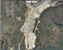
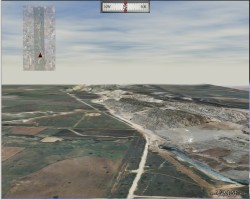
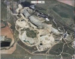
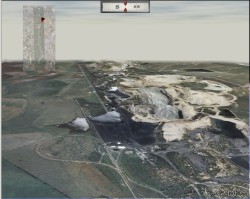
| VizMAP created the Moura Mine Fly Through as a part of the Surat project developed for the Queensland Department of Mines and Energy.
Producing 6.0Mtpa (50/50 metallurgical coal and thermal coal), the current Moura joint venture was established in July 2002, following Mitsui’s pre-emptive rights purchase from Coal and Allied of its 55% interest in the mining operation. Anglo Coal acquired a 51% share of the mine following agreement with Mitsui on an exchange in equity in other coal mining projects. Since 1996 Moura has been commercially extracting coal bed methane, which is piped into the State gas pipeline, enabling Moura to utilise its underground coal resources. (Source – the NRM "Green Book").
Click on these small resampled images to view the full screen images on the VizMAP website. Bear in mind that these are just screen dumps from a dynamic, interactive, 3D "flythrough".
If you would like more information on this project, let VizMAP know.
|
| If you have a need to dynamically visualise your geographic data, let VizMAP know your requirements… |
Back to Top |
| The Dawning of the G-Bomb |
from DirectionsMag |
| On the night of March 21, 2003, and for two weeks thereafter, the largest barrage in history rained down on Baghdad, Iraq, with such precision that the lights stayed on.
Baghdad, like Hiroshima, marks a new era in warfare impelled by weapons that eclipse all others before them. The atomic bomb, or A-bomb, brought a quantum leap in the magnitude of indiscriminate annihilation. Today’s geographically savvy weapons, let’s call them collectively the geographic bomb, or G-Bomb, brought a quantum leap in the precision with which selective destruction can be administered anywhere on Earth.
Both changed the nature of warfare forever, and the G-Bomb – relatively cost-free in allied casualties and guilt-free in civilian casualties – will be employed far more freely than the A-bomb ever could. The implications, both good and bad, for foreign policy, international relations, and global ethics are staggering.
Back home, the same technology that guides a missile can monitor and control a child, spouse, employee, or slave. Hence, geofencing is now commonplace and society must contemplate geoslavery, a new form of human bondage characterized by location control via human-tracking devices. The implications, both good and bad, for social relations, human rights, privacy, and freedom are staggering.
Earth-changing forces are at play, and it’s startling how little society seems to know or care. Following Baghdad’s "shock and awe," there’s been no prominent discussion of what the G-Bomb really is, much less what it’s impacts will be. It’s as if national leaders in 1945 had lauded the A-bomb without knowing or caring what lay behind it, and citizens had gawked at it’s mushroom cloud without concern.
The simplistic explanation for precision bombing, trumpeted by national leaders and pundits alike, is GPS, but that’s just one of many data streams flowing in a grand, global GIS that encompasses every battlefield. With GPS alone, a missile’s guidance system couldn’t distinguish Baghdad from Babylon, much less determine which buildings to hit, hills to dodge, and people to miss. As Robert McColl , professor emeritus of geography at the University of Kansas, once said, "If all you have is GPS, the best you can do is call fire in on yourself."
The G-Bomb demands GIS, a digital model of the earth that makes sense of all geographic information. It demands a system that faithfully records the precise three-dimensional geometry and descriptive attributes of all pertinent physical and cultural features (elevation, buildings, land cover, population, satellite imagery, boundaries, plus GPS-derived latitude/longitude coordinates of troops in the field and missiles in flight). It must keep track of highly complex spatial relationships among features. It must have the unique functionality of GIS to model, analyze, and display all features that occupy geographic space.
How, for instance, do troops know where not to shoot in order to avoid civilian casualties? It’s one thing to know where each bomb will fall, and GPS can tell you that. It’s quite another to know where the people are, and that requires a GIS. And make no mistake, avoiding civilian casualties is paramount in defense policy today. As one Pentagon officer said, "There are no single targets that are war winners, but many targets are war losers."
|
| Read that full story here |
Back to Top |
| Whazzup Next – with 20/20 Foresight… |
| Check these sites for events to look out for in the Vis/Sim, GIS, LIS, Remote Sensing & Photogrammetry calendars… |
|
| |
Back to Top |
A Parting Gesture… |
| Navajo Perspective |
From Grime |
| When NASA was preparing for the Apollo Project, it took the astronauts to a Navajo reservation in Arizona for training.
One day, a Navajo elder and his son came across the space crew walking among the rocks. The elder, who spoke only Navajo, asked a question.
His son translated for the NASA people: "What are these guys in the big suits doing?" One of the astronauts said that they were practicing for a trip to the moon. When his son relayed this comment the Navajo elder got all excited and asked if it would be possible to give to the astronauts a message to deliver to the moon.
Recognizing a promotional opportunity when he saw one, a NASA official accompanying the astronauts said, "Why certainly!" and told an underling to get a tape recorder. The Navajo elder’s comments into the microphone were brief.
The NASA official asked the son if he would translate what his father had said.
The son listened to the recording and laughed uproariously. But he refused to translate.
So the NASA people took the tape to a nearby Navajo village and played it for other members of the tribe. They too laughed long and loudly but also refused to translate the elder’s message to the moon.
Finally, an official government translator was summoned. After he finally stopped laughing the translator relayed the message:
"Watch out for these assholes. They have come to steal your land."
|
 |
Back to Top |
|
Feel free to forward this to whomsoever you wish.
To e-mail the VirtualGeography Editor, click here.
To subscribe to VirtualGeography, click here.
To unsubscribe from VirtualGeography, click here. |
| |
…that’s all, folks! (for now).
|
|
VizMAP
- Bureau & Services Portfolio
- Contact Us
- News
- Gladstone Port Access Road nearly complete after VizMAP visualisation convinces Council
- TerraTools Exporter for Virtual Battlespace 2 (VBS2) Now Available – 23/3/9
- Updated interactive “Flash Map” of Advanced Mining Projects in Queensland by VizMAP to be distributed to delegates of Mining 2006
- VizMAP & E2E deliver workshop at Queensland Spatial Conference, Brisbane, Queensland – 17/7/8
- VizMAP creates “virtual trek” to the Everest Base Camp
- VizMAP creates virtual coal mine for central Kalimantan
- VizMAP develops interactive “Flash Map” of Advanced Mining Projects in Queensland
- VizMAP imagery of Virtual Surat Energy Province awarded image of the month by Image Society Inc.
- VizMAP Launched
- VizMAP launches FlyLG: computer based geospatial Visualisation tailored to Australian local government areas
- VizMAP presents at Australia Pacific Spatial Innovation Conference 08, Canberra, ACT – 19/11/8
- VizMAP presents at GITA 07, Brisbane, Queensland – 8/8/7
- VizMAP presents at GITA Seminar, Darwin, Northern Territory – October, 2006
- VizMAP presents at Queensland Spatial Conference 2008, Brisbane, Queensland – 18/7/8
- VizMAP presents at Surveying and Spatial Sciences Institute (SSSI) Meeting, Hervey Bay
- VizMAP Presents TerraTours® Visualization at World Energy Congress
- VizMAP presents to Darling Downs Interest Group in GIS and Remote Sensing (DIGGARS) Seminar, USQ, Toowoomba, Queensland – 8/11/7
- VizMAP presents to International Map Trade Association (IMTA), Surfer’s Paradise, Queensland – 2/11/7
- VizMAP presents to Queensland Spatial Industry Council (QSIC), Brisbane, Queensland – 22/11/7
- VizMAP writes for Position Magazine – “The 3D Industry” – April-May 2007, No 28
- VizMAP’s Virtual Surat Energy Province
- VirtualGeography Index
- VizMAP
|


