|
|
vol 4 num 3

from VizMAP – letting you see where you stand…
Volume 4 Number 3
|
About VizMAP
VizMAP Pty Ltd, is a leading supplier of terrain Visualisation and related services to the defence, GIS, environmental, mapping, mining and exploration industries, engineering and construction firms, developers and planners, as well as government administration departments dealing with land, transportation and the environment.
VizMAP’s products are designed to be run on reasonably to highly configured graphics computers (PC, Linux and Unix) for public display, group training, mission rehearsal, environmental monitoring, etc. and to enhance management decision making.
VizMAP is headquartered on Queensland’s Sunshine Coast (Australia) with affiliation in Asia, Europe, Africa and the USA and thereby provides support and services to customers worldwide.
If you need to visualise anything geographic, e-mail VizMAP here with the details.
For more information about VizMAP visit the VizMAP Web site at http://www.vizmap.com.au.
|
VirtualGeography
Subscription
Details
To subscribe to VirtualGeography,
click here.
To unsubscribe from VirtualGeography,
click here.
|
A Moment’s Notice
"Is it true that cannibals don’t eat clowns because they taste funny?
 — Stephen Wright
|
|
VirtualGeography – the newsletter
|
| G’Day… and Welcome to VirtualGeography |
from here |
| Welcome to another free VirtualGeography from VizMAP Pty Ltd.
VizMAP has had a great few months since the last VirtualGeography with contracts to create interactive 3D visualisations for a number of customers, including one of a central Queensland mining area, a proposed coking coal mine in central Kalimantan and a trek through the Himalayas from Lukla to the Everest Base Camp.
If you didn’t already know, VirtualGeography is a collection of interesting snippets from all over the shop, dealing with industry issues concerning the computer based visualisation of geography and a few other associated (or otherwise) interesting bits and pieces. You are receiving this either because you subscribed to VirtualGeography or you have had recent dealings with VizMAP Pty Ltd. If you do not wish to receive further instalments of VirtualGeography, just click on the unsubscribe link at the bottom of this e-mail.
A new VirtualGeography is pushed out every now and then when we’ve collated enough interesting bits and pieces, which shouldn’t be too big a drain on your mailbox if you’re not already subscribed (of course it won’t be a drain on your mailbox if you ARE subscribed, either  ). The regularity of the distribution may vary depending on what else is going on at VizMAP at the time. If you know of anyone who might like to get VirtualGeography, feel free to forward this to them and ask them to subscribe. By the way, subscription and unsubscription details are at the bottom (click here). ). The regularity of the distribution may vary depending on what else is going on at VizMAP at the time. If you know of anyone who might like to get VirtualGeography, feel free to forward this to them and ask them to subscribe. By the way, subscription and unsubscription details are at the bottom (click here).
So, g’day to all you enthusiasts requiring to visualise and simulate both urban and rural geographic information (GIS), cartography, photogrammetry, remote sensing, digital elevation modelling (DEM) and general mapping.
By the spelling of "Visualisation" you may have already guessed that we’re not US based – that’s a good thing, or at least not a bad thing. This comes to you from Mooloolaba on the Sunshine Coast of Queensland, Australia, where it’s beautiful one day and perfect the next. As a postscript to that, you can have a look at the Mooloolaba beach, now, 800m from where I sit as I write this, here.
|
The link between visualisation and mapping may seem a little esoteric if this is your first encounter with this sort of stuff, but let me tell you, the bond is significant… but enough of that: on with the show… I hope you like it. Any feedback you might have is highly appreciated. E-mail me here to make your comments.
Enjoy…
Graeme Brooke
VizMAP Pty Ltd
|
 |
P.S. You’ll need an active internet connection to view any images that are in the content. We’ve done it this way to keep the size of the e-mail to a minimum.
|
| |
Back to Top |
| The Industry’s Two Cents Worth… |
| Google Earth (beta) |
from Google |
| "For anyone who has ever dreamed of flying…" – NY Times
The idea is simple. It’s a globe that sits inside your PC. You point and zoom to anyplace on the planet that you want to explore. Satellite images and local facts zoom into view. Tap into Google search to show local points of interest and facts. Zoom to a specific address to check out an apartment or hotel. View driving directions and even fly along your route. We invite you to try it now.
Google Earth is free for personal use. No registration is required. You may (optionally) choose to upgrade to Google Earth Plus.
Features:
- Free for personal use.
- Sophisticated streaming technology delivers the data to you as you need it.
- Imagery and 3D data depict the entire earth – Terabytes of aerial and satellite imagery depict cities around the world in high-resolution detail.
- Local search lets you search for restaurants, hotels, and even driving directions. Results show in your 3D earth view. Easy to layer multiple searches, save results to folders, and share with others.
- Layers show parks, schools, hospitals, airports, shopping, and more.
- KML – data exchange format let your share useful annotations and view. thousands of data points created by Google Earth users.
Use it for:
- Planning a trip
- Getting driving directions
- Finding a house or apartment
- Finding a local business
- Exploring the world
You can download Google Earth here. When you’ve done that, get this little file and double click on it to see where VizMAP operates from. |
| Read that full story here |
Back to Top |
| Hardcore Stuff (hardware bits)… |
| GeForce 7800 GTX: Nvidia’s Nuclear Option |
from ExtremeTech |
| Everybody loves graphics cards. Whether you’re hunting for the best high-performance mobile GPU or desktop graphics card with the best value, reading about the latest from the land of the pixel-pushers is the PC geek’s favorite pastime. Graphics are so important to the enthusiast market that we see people get fervently religious about them. Broken into the Red Camp (ATI) and the Green Camp (Nvidia), gamers and PC builders staunchly defend their favorite brands while throwing mud in the face of the other, treating anecdotal evidence as gospel and forming all opinions based on a top tier of $500+ cards that enjoys a market penetration of around 1%.
So, fellow PC graphics enthusiasts, rejoice! Today Nvidia takes the lid off its new GPU architecture, formerly code-named G70. We give you fuel for a whole new round of debates and forum flame wars and take a look at the fastest graphics card on the market, the GeForce 7800 GTX.
|
| Read that full story here |
Back to Top |
| Softcore Stuff (software & data bits)… |
| TerraSim to demonstrate DEMTools 1.0 at ESRI Users Group Meeting in San Diego, July 2005 |
from TerraSim |
| DEMTools from TerraSim® supports the fusion of multiple digital elevation models (DEM) as an extension to ArcGIS 8.3 and 9.x. Features of DEMtools 1.0 include novel automated DEM blending techniques, DEM hole filling, automated DEM matching and registration, resampling in arbitrary coordinate systems to arbitrary post spacing, and lake and ocean flattening tools. These capabilities provide ArcGIS users with powerful and robust methods for utilizing existing and emerging DEM data sources effectively in GIS applications.
DEMTools 1.0 is the product of a Phase II SBIR contract award sponsored by the U.S. Army Engineer Research and Development Center’s Topographic Engineering Center (ERDC/TEC), Fort Belvoir, Virginia. Demonstrations by ERDC/TEC sponsors and TerraSim developers were conducted at Booth D50 in the Defense Showcase Area.
|
| Read that full story here |
Back to Top |
| Lukla to the Everest Base Camp |
from VizMAP |
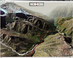
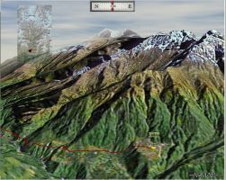
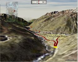
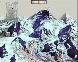
VizMAP developed this database for Centacare who were organising a trek from Nepal’s Lukla through to the Everest Base Camp. The visualisation included "floating labels" of the settlements and points of interest along the way as well as an indication of the actual trek route, depicted as a red line in the visualisation.
Click on these small resampled images to view the full screen images on the VizMAP website. Bear in mind that these are just screen dumps from a dynamic, interactive, 3D "flythrough".
If you would like more information on this project, let VizMAP know.
|
| If you have a need to dynamically visualise your geographic data, let VizMAP know your requirements… |
Back to Top |
| Berners-Lee on the read/write web |
from the BBC |
In August 1991, Sir Tim Berners-Lee created the first website. Fourteen years on, he tells BBC Newsnight’s Mark Lawson how blogging is closer to his original idea about a read/write web.
Mark Lawson: Because of your invention, I was able to look up every article written by or about you quickly and easily. But at the same time, I was sent several unsolicited links to porn sites. I have to accept that someone in Mexico may have stolen my identity and now be using it. Is the latter absolutely worth paying for the former?
Tim Berners-Lee: That’s an interesting question that you ask, as though it’s a yes or no answer. As though our choice is to turn off the whole thing, or turn on the whole thing. I feel that the web should be something, which basically doesn’t try to coerce people into putting particular sorts of things on it.
I feel that we need to individually work on putting good things on it, finding ways to protect ourselves from accidentally finding the bad stuff, and that at the end of the day, a lot of the problems of bad information out there, things that you don’t like, are problems with humanity.
This is humanity which is communicating over the web, just as it’s communicating over so many other different media. I think it’s a more complicated question we have to; first of all, make it a universal medium, and secondly we have to work to make sure that that it supports the sort of society that we want to build on top of it.
|
| Read that full story here |
Back to Top |
| Whazzup Next – with 20/20 Foresight… |
| Check these sites for events to look out for in the Vis/Sim, GIS, LIS, Remote Sensing & Photogrammetry calendars… |
|
| |
Back to Top |
A Parting Gesture… |
| Sister Mary |
From Grime |
| Sister Mary, who worked for a home health agency, was out making her rounds visiting homebound patients when she ran out of fuel. As luck would have it a petrol station was just a block away. She walked to the station to borrow a can and buy some petrol. The attendant told her the only can he owned had been loaned out but she could wait until it was returned. Since the nun was on the way to see a patient, she decided not to wait and walked back to her car. She looked for something in her car that she could fill and spotted the bedpan she was taking to the patient. Always resourceful she carried the bedpan to the station, filled it with petrol, and carried the full bedpan back to her car. As she was pouring it into her tank two men watched from across the street. One of them turned to the other and said,
"If it starts, I’m turning Catholic"
|
 |
Back to Top |
|
Feel free to forward this to whomsoever you wish.
To e-mail the VirtualGeography Editor, click here.
To subscribe to VirtualGeography, click here.
To unsubscribe from VirtualGeography, click here. |
| |
…that’s all, folks! (for now).
|
|
VizMAP
- Bureau & Services Portfolio
- Contact Us
- News
- Gladstone Port Access Road nearly complete after VizMAP visualisation convinces Council
- TerraTools Exporter for Virtual Battlespace 2 (VBS2) Now Available – 23/3/9
- Updated interactive “Flash Map” of Advanced Mining Projects in Queensland by VizMAP to be distributed to delegates of Mining 2006
- VizMAP & E2E deliver workshop at Queensland Spatial Conference, Brisbane, Queensland – 17/7/8
- VizMAP creates “virtual trek” to the Everest Base Camp
- VizMAP creates virtual coal mine for central Kalimantan
- VizMAP develops interactive “Flash Map” of Advanced Mining Projects in Queensland
- VizMAP imagery of Virtual Surat Energy Province awarded image of the month by Image Society Inc.
- VizMAP Launched
- VizMAP launches FlyLG: computer based geospatial Visualisation tailored to Australian local government areas
- VizMAP presents at Australia Pacific Spatial Innovation Conference 08, Canberra, ACT – 19/11/8
- VizMAP presents at GITA 07, Brisbane, Queensland – 8/8/7
- VizMAP presents at GITA Seminar, Darwin, Northern Territory – October, 2006
- VizMAP presents at Queensland Spatial Conference 2008, Brisbane, Queensland – 18/7/8
- VizMAP presents at Surveying and Spatial Sciences Institute (SSSI) Meeting, Hervey Bay
- VizMAP Presents TerraTours® Visualization at World Energy Congress
- VizMAP presents to Darling Downs Interest Group in GIS and Remote Sensing (DIGGARS) Seminar, USQ, Toowoomba, Queensland – 8/11/7
- VizMAP presents to International Map Trade Association (IMTA), Surfer’s Paradise, Queensland – 2/11/7
- VizMAP presents to Queensland Spatial Industry Council (QSIC), Brisbane, Queensland – 22/11/7
- VizMAP writes for Position Magazine – “The 3D Industry” – April-May 2007, No 28
- VizMAP’s Virtual Surat Energy Province
- VirtualGeography Index
- VizMAP
|


