|
|
vol 4 num 4

from VizMAP – letting you see where you stand…
Volume 4 Number 4
|
About VizMAP
VizMAP Pty Ltd, is a leading supplier of terrain Visualisation and related services to the defence, GIS, environmental, mapping, mining and exploration industries, engineering and construction firms, developers and planners, as well as government administration departments dealing with land, transportation and the environment.
VizMAP’s products are designed to be run on reasonably to highly configured graphics computers (PC, Linux and Unix) for public display, group training, mission rehearsal, environmental monitoring, etc. and to enhance management decision making.
VizMAP is headquartered on Queensland’s Sunshine Coast (Australia) with affiliation in Asia, Europe, Africa and the USA and thereby provides support and services to customers worldwide.
If you need to visualise anything geographic, e-mail VizMAP here with the details.
For more information about VizMAP visit the VizMAP Web site at http://www.vizmap.com.au.
|
VirtualGeography
Subscription
Details
To subscribe to VirtualGeography,
click here.
To unsubscribe from VirtualGeography,
click here.
|
A Moment’s Notice
"It isn’t necessary to have relatives in Kansas City in order to be unhappy". — Groucho Marx

|
|
VirtualGeography – the newsletter
|
| G’Day… and Welcome to VirtualGeography |
from here |
| Welcome to another free VirtualGeography from VizMAP Pty Ltd.
VizMAP has been busy this month creating Coal and Commodity databases using Flash for the Queensland Government Department of Natural Resources and Mines and helping with the installation of another GeoSim Helicopter Part Task Trainer at Chopperline in Caloundra, Queensland. Never a dull moment here.
If you didn’t already know, VirtualGeography is a collection of interesting snippets from all over the shop, dealing with industry issues concerning the computer based visualisation of geography and a few other associated (or otherwise) interesting bits and pieces. You are receiving this either because you subscribed to VirtualGeography or you have had recent dealings with VizMAP Pty Ltd. If you do not wish to receive further instalments of VirtualGeography, just click on the unsubscribe link at the bottom of this e-mail.
A new VirtualGeography is pushed out every now and then when we’ve collated enough interesting bits and pieces, which shouldn’t be too big a drain on your mailbox if you’re not already subscribed (of course it won’t be a drain on your mailbox if you ARE subscribed, either  ). The regularity of the distribution may vary depending on what else is going on at VizMAP at the time. If you know of anyone who might like to get VirtualGeography, feel free to forward this to them and ask them to subscribe. By the way, subscription and unsubscription details are at the bottom (click here). ). The regularity of the distribution may vary depending on what else is going on at VizMAP at the time. If you know of anyone who might like to get VirtualGeography, feel free to forward this to them and ask them to subscribe. By the way, subscription and unsubscription details are at the bottom (click here).
So, g’day to all you enthusiasts requiring to visualise and simulate both urban and rural geographic information (GIS), cartography, photogrammetry, remote sensing, digital elevation modelling (DEM) and general mapping.
By the spelling of "Visualisation" you may have already guessed that we’re not US based – that’s a good thing, or at least not a bad thing. This comes to you from Mooloolaba on the Sunshine Coast of Queensland, Australia, where it’s beautiful one day and perfect the next. As a postscript to that, you can have a look at the Mooloolaba beach, now, 800m from where I sit as I write this, here.
|
The link between visualisation and mapping may seem a little esoteric if this is your first encounter with this sort of stuff, but let me tell you, the bond is significant… but enough of that: on with the show… I hope you like it. Any feedback you might have is highly appreciated. E-mail me here to make your comments.
Enjoy…
Graeme Brooke
VizMAP Pty Ltd
|
 |
P.S. You’ll need an active internet connection to view any images that are in the content. We’ve done it this way to keep the size of the e-mail to a minimum.
|
| |
Back to Top |
| The Industry’s Two Cents Worth… |
| Carbon Project Announces New Portal for the Open-Geospatial .NET Community |
from GeoLeaders |
| Washington, DC, August 1, 2005 – The Carbon Project today announced a new resource designed to help the growing Open-Geospatial .NET Community, The Carbon Portal. Through The Carbon Portal, anyone will be able to join the Open-Geospatial .NET Community at no cost, exchange ideas, source code and find support among others seeking to advance open-geospatial interoperability.
“The Carbon Portal, located at www.TheCarbonPortal.net, is designed to support the interest shown in CarbonTools and other Open-Geospatial .NET tools. For example, downloads of the CarbonTools free toolkit exceeded 2,000 in the first eight weeks after release and these users need a collaborative space to exchange ideas and code. The new Carbon Portal will extend this global interest to a broad community, helping mainstream IT users implement open-geospatial interoperability in a wide range of applications,” said Jeff Harrison, President of The Carbon Project.
Based on the Microsoft .NET Framework, CarbonTools provides a powerful and extendible API for accessing geospatial web services based on Open Geospatial Consortium (OGC™) specifications including GML, OGC’s XML encoding for geospatial information.
|
| Read that full story here |
Back to Top |
| Hardcore Stuff (hardware bits)… |
| Intel Pledges 1500 PCs, Wireless Access Points, Technical Support For Hurricane Katrina Disaster Relief Efforts |
from Intel |
| Company Working With American Red Cross to Provide Critical Communications Support
SANTA CLARA, Calif., Sept. 2, 2005 – Intel Corporation today announced it is coordinating the donation of 1,500 laptop personal computers to the American Red Cross for distribution to shelters in support of Hurricane Katrina disaster relief efforts. In addition, Intel will donate 150 wireless Internet access points to enable wireless local area connectivity in all permanent shelters and is providing fifty Wi-Fi transmitters for installation in the New Orleans downtown and airport area.
Intel employees will provide on-site technical assistance to ensure the success of all technical deployments. The PCs will be configured by Intel and its partners according to Red Cross requirements to allow shelters to exchange important information with the organization’s headquarters regarding victim status, resource needs and case management. These systems, along with broadband access, will also provide the technology backbone that provides thousands of hurricane victims with a means of communicating with relatives, verifying their identity for emergency fund distribution, contacting social services and accessing information important to their relocation.
"The catastrophic situation created by Hurricane Katrina is unprecedented in this nation," said Intel President and CEO Paul Otellini. "Intel and our employees are compelled to help the thousands who have been affected by this tragedy by offering our technical expertise and resources to assist with this critical phase of the recovery efforts."
Intel is donating some of its own systems and is pooling donations from such original equipment manufacturers as Dell and Lenovo to distribute over the weekend. The equipment will be up and running early next week.
Communications problems have been a major challenge in coordinating disaster recovery, rescue and care efforts. Intel is working with major telecommunications companies to evaluate connectivity conditions at American Red Cross shelters in the region. Wherever possible, Intel’s partners will enable these locations with either DSL or T-1 broadband access. In locations where landline access is not possible, Intel will offer broadband wireless equipment to ensure that all shelters have broadband Internet access.
|
| Read that full story here |
Back to Top |
| Softcore Stuff (software & data bits)… |
| Space Imaging’s view of Hurricane Katrina |
from Space Imaging |
| Click here to be taken to the extraordinary satellite views of the aftermath of hurricane Katrina:
Explore Side by Side Comparisons:
New Orleans, Louisiana
Gulfport, Mississippi
Pascagoula, Mississippi
Biloxi, Mississippi
Mobile, Alabama
Hurricane Katrina before & after images:
New Orleans-1
New Orleans-2
New Orleans-3
New Orleans-4
New Orleans-5
New Orleans-6
Biloxi-1
Biloxi-2
Gulfport-1
Gulfport-2
Pascagoula-1
Pascagoula-2
|
| Read that full story here |
Back to Top |
| Queensland Commodities for Natural Resources and Mines |
from VizMAP |
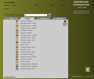
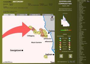
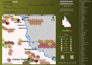
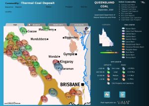
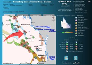
| VizMAP was engaged by the Queensland Government Department of Natural Resources and Mines to create a dynamic and interactive 2D map of Queensland’s Commodities, including Coal. This doesn’t fit neatly with VizMAP’s 3D policy, but, hey, we can do anything!
The "Commodities" and "Coal" databases were developed in Macromedia’s Flash environment and are available online:
They are currently being printed to CD and will be available from NRM soon.
Click on these small resampled images to view the full screen images on the VizMAP website. Bear in mind that these are just screen dumps from a dynamic, interactive application.
If you would like more information on this project, let VizMAP know
|
| If you have a need to dynamically visualise your geographic data, let VizMAP know your requirements… |
Back to Top |
| Joy, oh, joystick |
from the Age |
| IR Gurus is a Melbourne-based development studio, until now only really known for its AFL Live series and niche equestrian titles.
Heroes of the Pacific, a fight combat sim, heralds the Aussie company’s first big action title – and what a way to get off the ground!
What’s immediately striking about Heroes is its lovingly crafted presentation. Every menu and options screen is constructed in the style of 1930s and ’40s movie posters and comic book covers.
This exceptional art direction immerses you in a charming "boys own" adventure atmosphere that belies the seriousness of the subject matter, the Pacific theatre of operations in World War II.
Players take the role of Crowe, a green pilot in the US Air Force who’s thrown straight into the thick of things with the infamous surprise attack on Pearl Harbour.
Piloting any of the 35 authentic aircraft in the game is possible via two different control schemes, Arcade or Professional, allowing gamers of any skill level to jump right in and quickly get to grips with their virtual joystick.
Dogfights Japanese Zeros and Raidens easily provide the biggest buzz, but you’ll also learn the art of dive-bombing, dropping torpedoes and commanding your own wingmen in battle.
Some of the bombing runs in the solo campaign can prove quite arduous, but the dazzling pyrotechnics and adrenaline rush of flying your P38 Lightning through anti-aircraft fire make it easy to press the restart button if you fail your objectives.
There’s also the option of tackling specific Historical Battle challenges, the ease of an Instant Action mode and a host of multiplayer options that include split-screen and system link play, as well as an addictive range of online team matches. Get your goggles on and fly the unfriendly skies.
|
| Read that full story here |
Back to Top |
| Whazzup Next – with 20/20 Foresight… |
| Check these sites for events to look out for in the Vis/Sim, GIS, LIS, Remote Sensing & Photogrammetry calendars… |
|
| |
Back to Top |
A Parting Gesture… |
| The Workout |
From Grime |
| The Doctor told me I should start an exercise program. Not wanting to harm this old body, I’ve devised the following:
Beat around the bush
Jump to conclusions
Climb the walls
Wade through the morning paper
Drag my heels
Push my luck
Make Mountains out of mole hills
Hit the nail on the head
Bend over backwards
Jump on the Band Wagon
Run around in circles
Toot my own horn
Pull out all the stops
Add fuel to the fire
Open a can of worms
Put my foot in my mouth
Start the ball rolling
Go over the edge
Pick up the pieces.
Kneel in prayer
Bow my head in thanksgiving
Uplift my hands in praise
Hug someone and encourage them
What a Workout!!
Rest At Last!!
|
 |
Back to Top |
|
Feel free to forward this to whomsoever you wish.
To e-mail the VirtualGeography Editor, click here.
To subscribe to VirtualGeography, click here.
To unsubscribe from VirtualGeography, click here. |
| |
…that’s all, folks! (for now).
|
|
VizMAP
- Bureau & Services Portfolio
- Contact Us
- News
- Gladstone Port Access Road nearly complete after VizMAP visualisation convinces Council
- TerraTools Exporter for Virtual Battlespace 2 (VBS2) Now Available – 23/3/9
- Updated interactive “Flash Map” of Advanced Mining Projects in Queensland by VizMAP to be distributed to delegates of Mining 2006
- VizMAP & E2E deliver workshop at Queensland Spatial Conference, Brisbane, Queensland – 17/7/8
- VizMAP creates “virtual trek” to the Everest Base Camp
- VizMAP creates virtual coal mine for central Kalimantan
- VizMAP develops interactive “Flash Map” of Advanced Mining Projects in Queensland
- VizMAP imagery of Virtual Surat Energy Province awarded image of the month by Image Society Inc.
- VizMAP Launched
- VizMAP launches FlyLG: computer based geospatial Visualisation tailored to Australian local government areas
- VizMAP presents at Australia Pacific Spatial Innovation Conference 08, Canberra, ACT – 19/11/8
- VizMAP presents at GITA 07, Brisbane, Queensland – 8/8/7
- VizMAP presents at GITA Seminar, Darwin, Northern Territory – October, 2006
- VizMAP presents at Queensland Spatial Conference 2008, Brisbane, Queensland – 18/7/8
- VizMAP presents at Surveying and Spatial Sciences Institute (SSSI) Meeting, Hervey Bay
- VizMAP Presents TerraTours® Visualization at World Energy Congress
- VizMAP presents to Darling Downs Interest Group in GIS and Remote Sensing (DIGGARS) Seminar, USQ, Toowoomba, Queensland – 8/11/7
- VizMAP presents to International Map Trade Association (IMTA), Surfer’s Paradise, Queensland – 2/11/7
- VizMAP presents to Queensland Spatial Industry Council (QSIC), Brisbane, Queensland – 22/11/7
- VizMAP writes for Position Magazine – “The 3D Industry” – April-May 2007, No 28
- VizMAP’s Virtual Surat Energy Province
- VirtualGeography Index
- VizMAP
|


